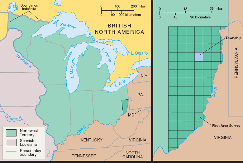
Map 8.2 The Northwest Ordinance and the Ordinance of 1785
Surveyors mapping the Northwest Territory followed the Ordinance of 1785, using the stars as well as poles and chains (standard surveying equipment) to run boundary lines. The result was a blanket of six-mile-square townships, subdivided into one-mile squares each containing sixteen 40-acre farms.