Map Activity 1 for Chapter 11
Printed Page 297
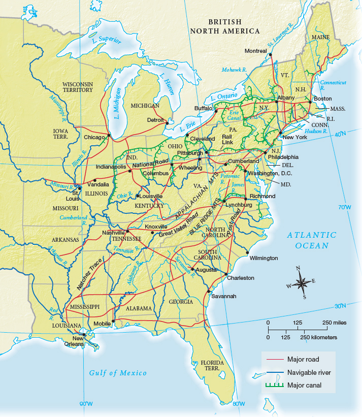
Figure false: MAP 11.1 Routes of Transportation in 1840
Figure false: Transportation advances cut travel times significantly. On the Erie Canal, goods and people could move from New York City to Buffalo in four days, a two-week trip by road. Steamboats cut travel time from New York to New Orleans from four weeks by road to less than two weeks by river.
Figure false: MAP ACTIVITY
Question
READING THE MAP: In what parts of the country were canals built most extensively? Were most of them within a single state’s borders, or did they encourage interstate travel and shipping?
Question
CONNECTIONS: What impact did the Erie Canal have on the development of New York City? How did improvements in transportation affect urbanization in other parts of the country?