Map Activity 2 for Chapter 19
Printed Page 550
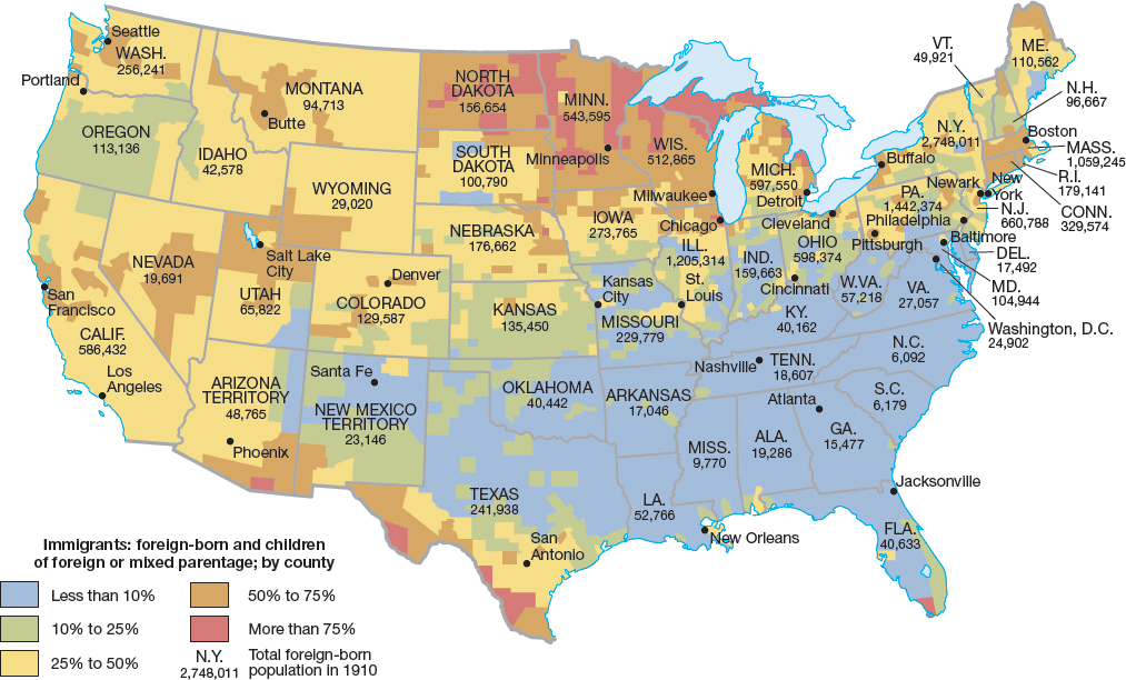
Figure false: MAP 19.2 The Impact of Immigration, to 1910
Figure false: Immigration flowed in all directions — south from Canada, north from Mexico and Latin America, east from Asia, and west from Europe.
Figure false: MAP ACTIVITY
Question
READING THE MAP: Which states had high percentages of immigrants? Which cities attracted the most immigrants? Which cities attracted the fewest?
Question
CONNECTIONS: Why did most immigrants gravitate toward the cities? Why do you think the South drew such a low percentage of immigrants?