Map Activity 2 for Chapter 26
Printed Page 798
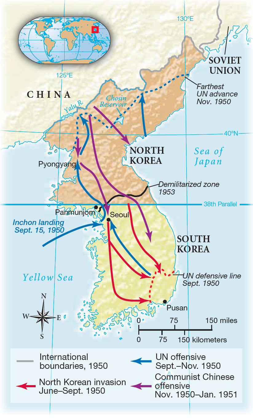
Figure false: MAP 26.3 The Korean War, 1950–1953
Figure false: Although each side had plunged deep into enemy territory, the war ended in 1953 with the dividing line between North and South Korea nearly where it had been before the fighting began.
Figure false: MAP ACTIVITY
Question
READING THE MAP: How far south did the North Korean forces progress at the height of their invasion? How far north did the UN forces get? What countries border Korea?
Question
CONNECTIONS: What dangers did the forays of MacArthur’s forces to within forty miles of the Korean-Chinese border pose? Why did Truman forbid MacArthur to approach that border? What political considerations on the home front influenced Truman’s policy and military strategy regarding Korea?