Map Activity 2 for Chapter 4
Printed Page 103
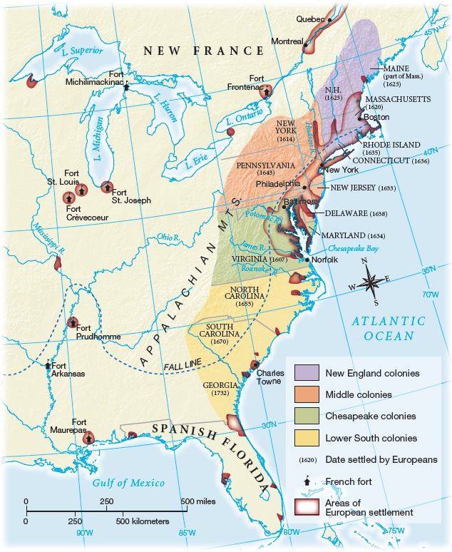
Figure false: MAP 4.3 American Colonies at the End of the Seventeenth Century
Figure false: By the end of the seventeenth century, settlers inhabited a narrow band of land that stretched from Boston to Norfolk, with pockets of settlement farther south. The colonies’ claims to enormous tracts of land to the west were contested by Native Americans as well as by France and Spain.
Figure false: > MAP ACTIVITY
Question
READING THE MAP: What geographic feature acted as the western boundary for colonial territorial claims? Which colonies were the most settled and which the least?
Question
CONNECTIONS: The map divides the colonies into four regions. Can you think of an alternative organization? On what criteria would it be based?