Visual Activity for Chapter 8
Printed Page 218
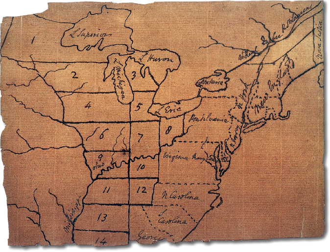
Jefferson’s Map of the Northwest Territory
Thomas Jefferson proposed nine states in his initial plan for the Northwest Territory in 1784. Straight lines and right angles held a strong appeal for him. But such regularity ignored inconvenient geographic features such as rivers and even more inconvenient political facts such as Indian territorial claims. William L. Clements Library.
> VISUAL ACTIVITY
Question 1.3
READING THE IMAGE: What does this map indicate about Jefferson’s vision of the Northwest Territory?
Question 1.4
CONNECTIONS: What were the problems with Jefferson’s design for the division of the territory? Why did the congress alter it in the land ordinances of 1784, 1785, and 1787?