Map Activity 1 for Chapter 9
Printed Page 241
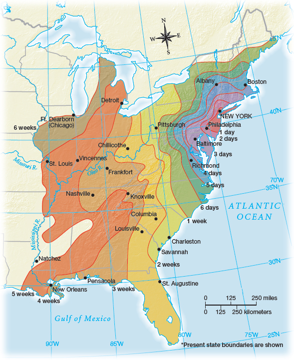
Figure false: MAP 9.1 Travel Times from New York City in 1800
Figure false: Notice that travel out of New York extends over a much greater distance in the first week than in subsequent weeks. River corridors in the West and East speeded up travel — but only going downriver. Also notice that travel by sea (along the coast) was much faster than land travel.
Figure false: MAP ACTIVITY
Question
READING THE MAP: Compare this map to the map “Major Roads in the 1790s” and to Map 9.2. What physical and cultural factors account for the slower travel times west of Pittsburgh?
Question
CONNECTIONS: Why did Americans in the 1790s become so interested in traveling long distances? How did travel times affect the U.S. economy?