MAP ACTIVITY
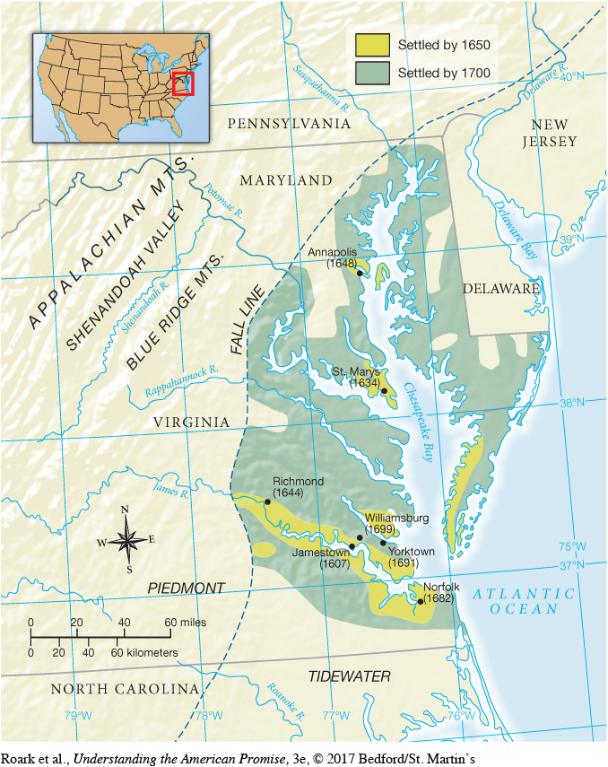
MAP 3.1 Chesapeake Colonies in the Seventeenth Century This map illustrates the intimate association between land and water in the settlement of the Chesapeake in the seventeenth century. The fall line indicates the limit of navigable water, where rapids and falls prevented travel farther upstream.
READING THE MAP: Using the notations on the map, create a chronology of the establishment of towns and settlements. What physical features correspond to the earliest habitation by English settlers?
CONNECTIONS: Why was access to navigable water so important? Given the settlers’ need for defense against native tribes, what explains the distance between settlements?