MAP ACTIVITY
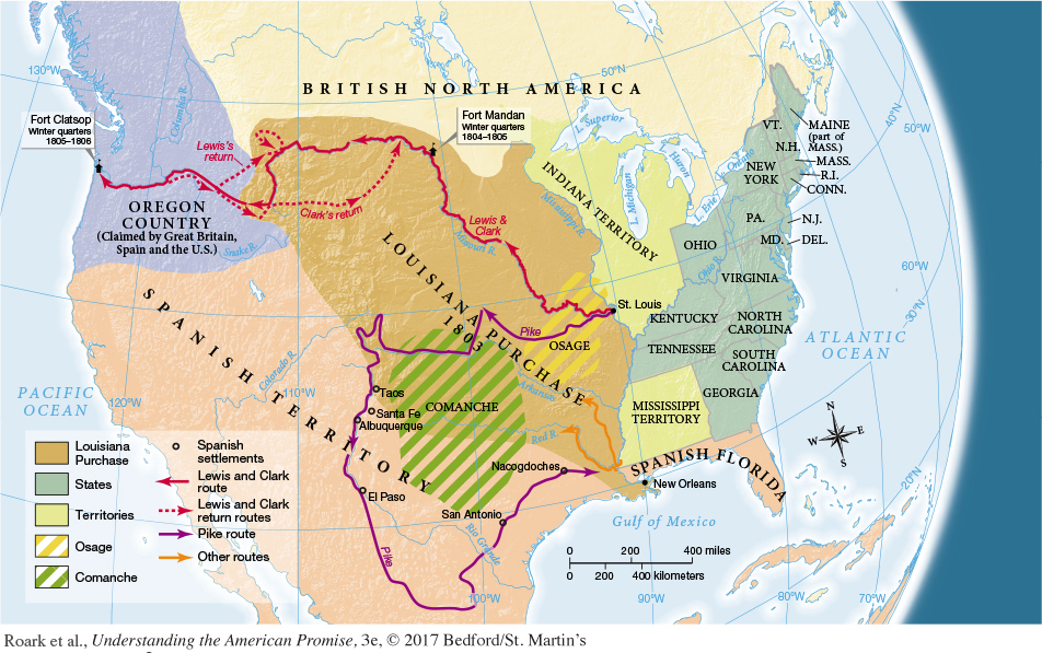
MAP 10.2 Jefferson’s Expeditions in the West, 1804–1806 The Louisiana Purchase of 1803 brought the United States a large territory without clear boundaries. Jefferson sent off four scientific expeditions to take stock of the land’s possibilities and to assess the degree of potential antagonism from Indian and Spanish inhabitants.
READING THE MAP: How did the size of the newly acquired territory compare to the land area of the existing American states and territories? What natural features of the land might have suggested boundaries for the Louisiana Purchase? Did those natural features coincide with actual patterns of human habitation already in place?
CONNECTIONS: What political events in Europe created the opportunity for the Jefferson administration to purchase Louisiana? How did the acquisition of Louisiana affect Spain’s hold on North America?