MAP ACTIVITY
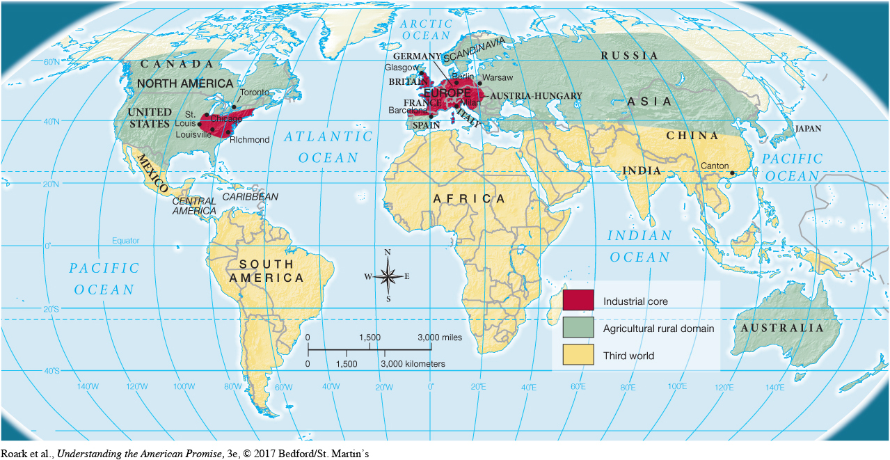
MAP 19.1 Economic Regions of the World, 1890 The global nature of the world economy at the turn of the twentieth century is indicated by three interconnected geographic regions. At the center stands the industrial core—western Europe and the northeastern United States. The second region—the agricultural periphery—supplied immigrant laborers to the industries in the core. Beyond these two regions lay a vast area tied economically to the industrial core by colonialism.
READING THE MAP: What types of economic regions were contained in the United States in this period? Which continents held most of the industrial core? Which held most of the agricultural rural domain? Which held the greatest portion of the third world?
CONNECTIONS: Which of these three regions provided the bulk of immigrant workers to the United States? What major changes prompted the global migration at the end of the nineteenth century?