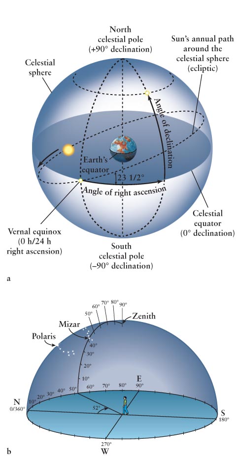
Figure 1-6The Celestial Sphere and Coordinate Systems (a) The celestial sphere is the apparent “bowl” or hollow sphere of the sky. The celestial equator and poles are projections of Earth’s equator and axis of rotation onto the celestial sphere. The north celestial pole is therefore located directly over Earth’s North Pole, while the south celestial pole is directly above Earth’s South Pole. Analogous to longitude and latitude on Earth, the coordinates in space are right ascension (R.A.) and declination (Dec.), respectively. The star in this figure has the indicated R.A. and Dec. (b) Altitude and azimuth create a local coordinate system for every place on Earth. Altitude is the angle straight up from the horizon. Azimuth is the angle eastward from north along the horizon. To find Mizar at 10 p.m. on March 14, 2013, as seen from Orono, Maine, we calculate its coordinates there as altitude 47° and azimuth 52° and use them to locate it in the night sky.