REGION
2.1
LEARNING OBJECTIVE
Explain the role of cultural difference in shaping regions.
COLLEGE SPORTS AS AN EXPRESSION OF CULTURE REGIONS
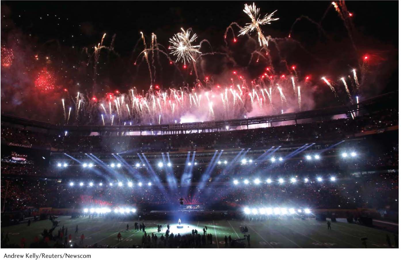
Attending or watching sporting events on television is a major part of popular culture. The biggest sports spectacle in the United States is unquestionably the Super Bowl, the annual championship game of the National Football League, the country’s premier professional (American) football association. The Super Bowl is so broadly popular across the country that it functions as an unofficial national holiday (Figure 2.13). Only on Thanksgiving is more food consumed on a single day in the United States. Television broadcasts of the game commonly record the largest viewership of the year for any single event or program. Many observers have come to view the sport as a symbol of American national culture.
When we think of college sports, chances are football comes to mind first. Successful college football programs tend to define universities and draw national publicity unmatched by that earned from other sports or academic achievements. Universities, however, compete with one another in dozens of other sports. Most of these sports do not have the broad national appeal of football. Rather, the vast majority of sports sponsored by the National Collegiate Athletic Association (NCAA) have distinctive regional associations. Frequently, these regional associations can be traced back in time to folk traditions emerging in specific places.
51
Let’s look at just three of the dozens of sports that the NCAA sponsors for men in its Division I category: ice hockey, lacrosse, and volleyball. For each of these sports, a geographic pattern soon emerges: a clustering of universities that offer them.
Ice Hockey Beginning with ice hockey, there is a clear concentration of teams in the northern states east of the Rocky Mountains (Figure 2.14). Michigan counts 7 of the 59 college teams, while only one team, the University of Alabama-Huntsville, is located in the South. Only three teams may be found in the western United States, all of which are clustered around Denver, Colorado.
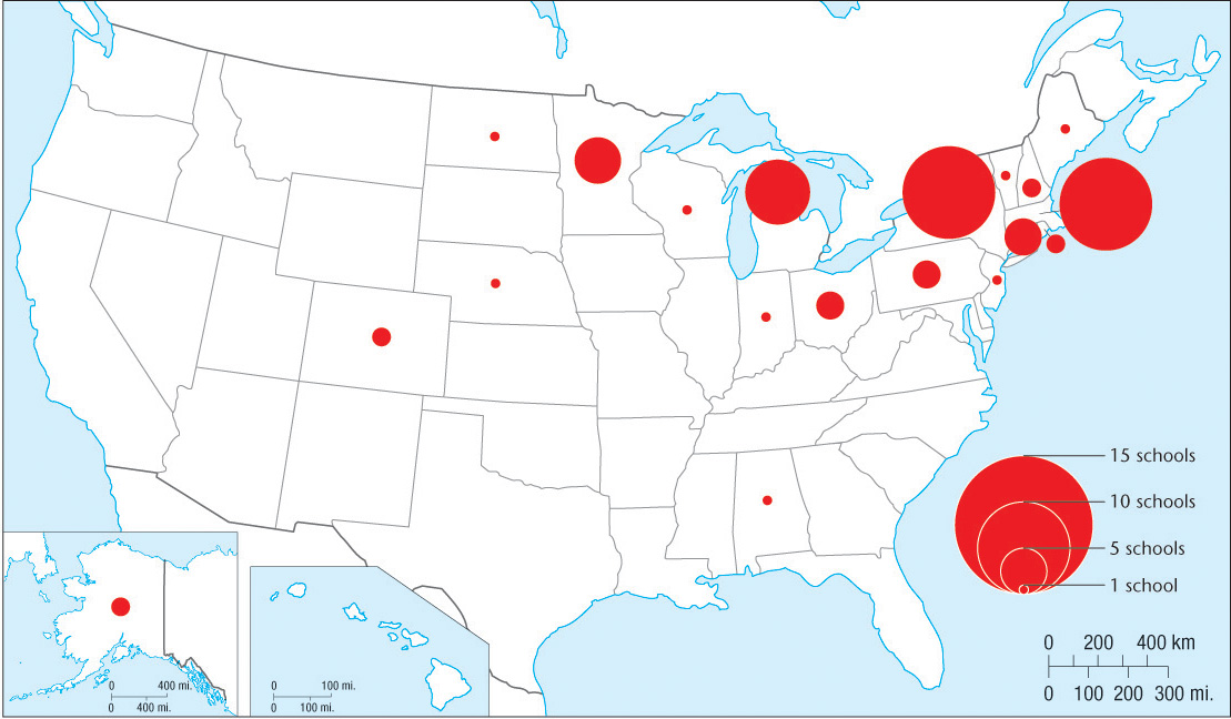
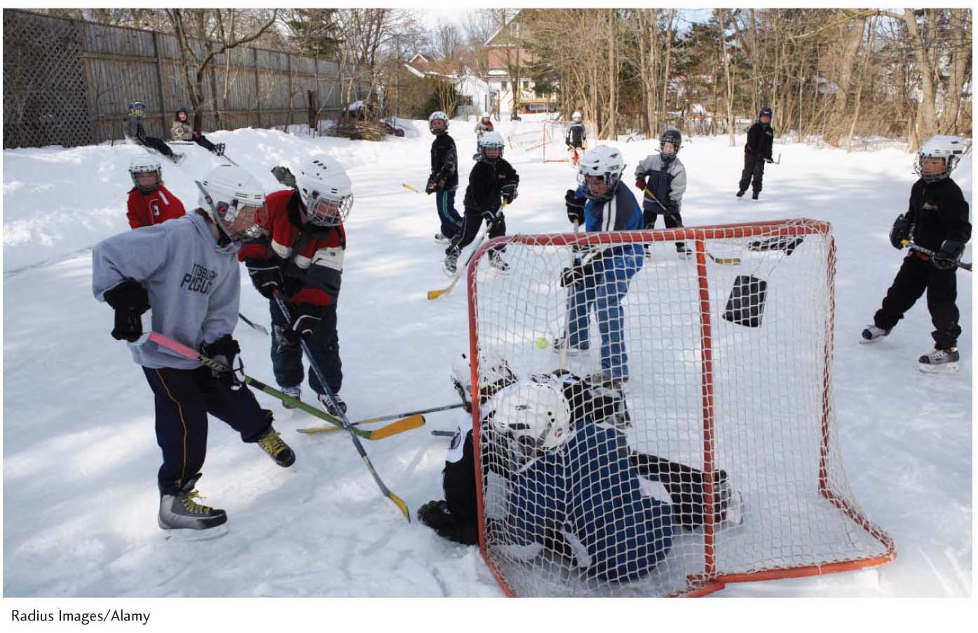
A clearly defined collegiate ice-hockey region thus exists in the northern United States. Furthermore, the number of ice hockey teams in the region—and the absence of the sport in other regions—are closely associated with the geographic origins and development of the sport. Modern ice hockey emerged in eastern Canada in the nineteenth century. Its invention appears to be rooted in the stick and ball games of the indigenous peoples of the region as well as winter folk traditions imported from Europe. Student enthusiasts formed the first ice hockey club with formal rules at Canada’s McGill University in 1877. The sport spread from there, restricted almost exclusively to areas that experienced winters long and cold enough to form outdoor ice hockey rinks. Neighborhood kids organized games whenever and wherever it was cold enough for a local pond or creek to freeze over (Figure 2.15). By the time technology made indoor ice rinks feasible anywhere, the regional cultural preferences had been already established.
52
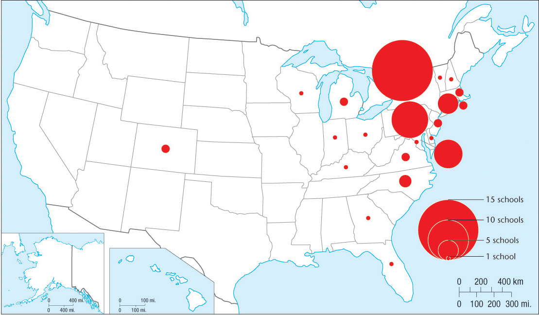
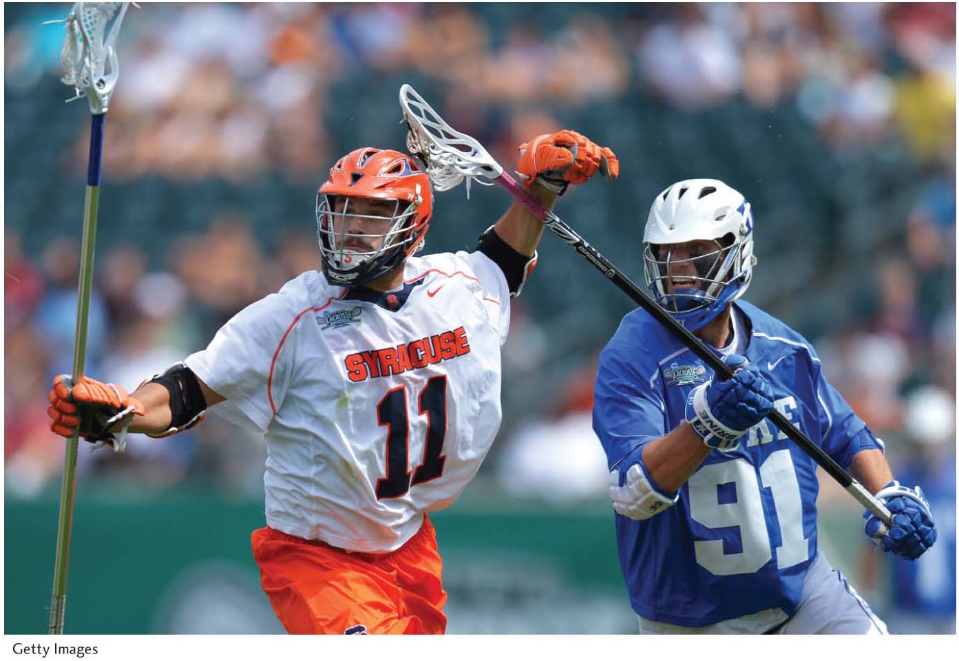
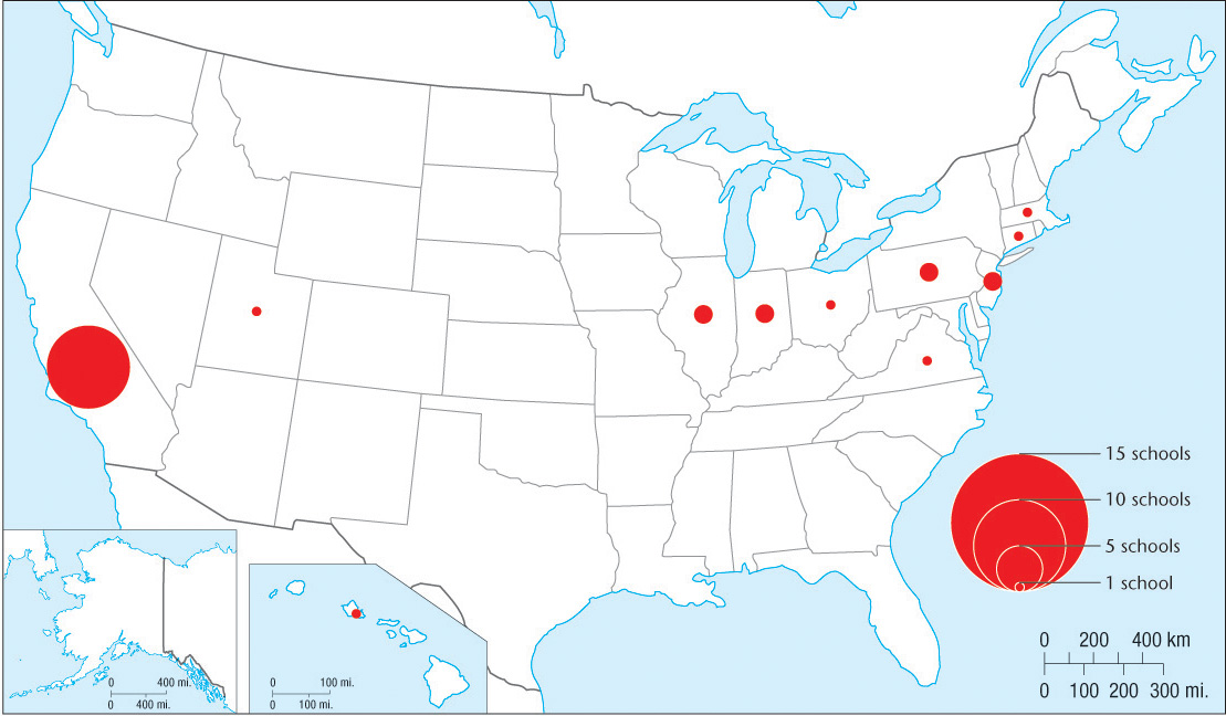
Lacrosse The NCAA’s 63 college lacrosse teams also exhibit a distinctive regional clustering, with the heaviest concentration found in the Northeast (Figure 2.16). As with ice hockey, lacrosse has flourished close to its point of geographic origin. It is derived from a game played by the indigenous peoples of eastern Canada. European Canadians created the formal rules for modern lacrosse in 1867 and intercollegiate competition followed soon thereafter. The Ivy League universities and private liberal arts colleges of the northeast United States established the first teams, followed by a few large public universities, such as the University of Michigan (Figure 2.17). At the college level, lacrosse is virtually unknown west of the Rocky Mountains.
53
Volleyball Our final example, volleyball, has a history and regional pattern different from those of lacrosse and ice hockey. There are far fewer Division I college volleyball teams—only 33—and they are concentrated in three separate regions: the West Coast, the Midwest, and the Northeast (Figure 2.18). The game itself was invented by an educator/physician working for the Young Men’s Christian Association (YMCA) in Massachusetts in 1896 as part of an adult health and fitness program.
Although the game has since spread throughout the United States and beyond, college-level competition developed a separate and unanticipated geographic pattern. Volleyball was increasingly associated with a particular environment and culture far from its Massachusetts origin and with a particular set of regional cultural values very different from those of the nineteenth-century YMCA. By the 1960s, volleyball, like surfing, had become symbolically associated with Southern California’s beach culture (Figure 2.19). As with hockey on winter days in the North, kids in Southern California spent their summer days playing pickup volleyball on the beach or at neighborhood outdoor sand courts. Today, there is a strong concentration of college teams in California, where 9 of the 33 Division I teams are located. While three separate regional concentrations exist, California universities dominate the sport. In 43 years of Division I championships, California teams have won all but eight championships and all but one of those teams is located in the southern half of the state. College sports are clearly useful for thinking about and identifying regional cultural patterns.

54
INDIGENOUS CULTURE REGIONS
Indigenous peoples generally live in areas with few roads or modern communications systems, such as mountainous areas, vast arid and semiarid regions, or large expanses of forest or wetlands. These concentrations of people constitute indigenous culture regions. Worldwide, large concentrations of indigenous populations exist outside of the strong influence of national cultures and the control of governments located in faraway capital cities. Control of indigenous regions by a central government is often weakened by the minimal infrastructure, rough topography, or harsh environmental conditions of the region. In many cases, indigenous peoples either fled or were forcibly removed by central governments to environmentally marginal regions, such as arid lands.
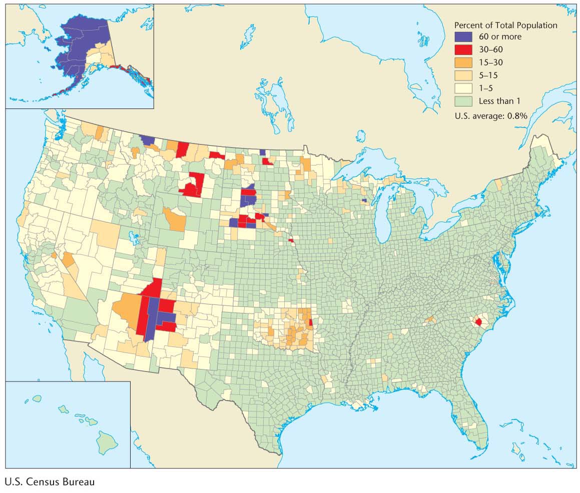
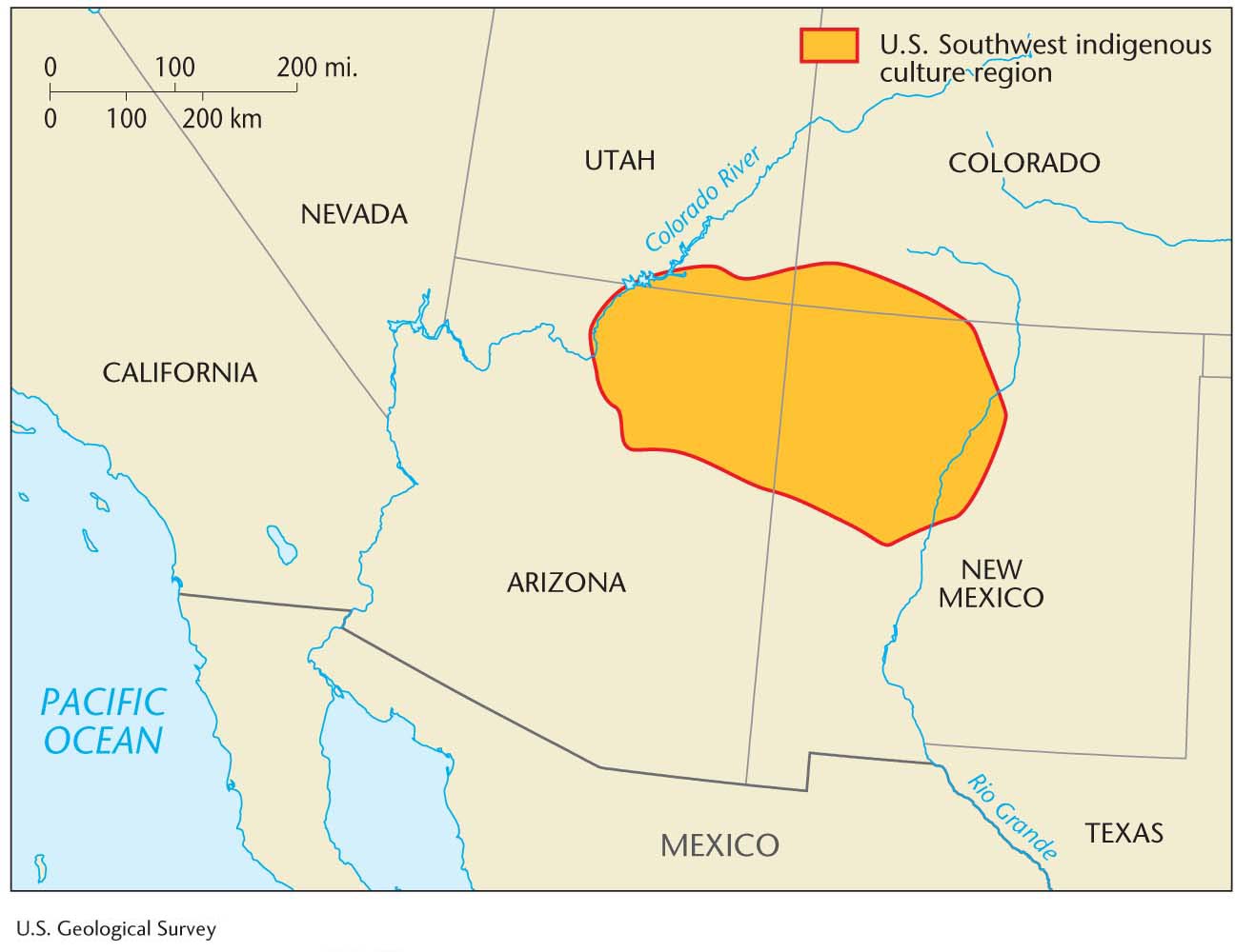
In the United States and Canada, for example, this geographic pattern of marginalization is particularly evident. In the United States, the central government has had a complex and often contradictory relationship with indigenous peoples, sometimes treating them as independent nations and at other times as second-class citizens. The way in which indigenous peoples are distributed in the United States reflects both the history of the east-to-west movement of European settlers and nineteenth-century government policies (Figure 2.20). For example, the Indian Removal Act of 1830 was intended to make way for European settlers by relocating eastern Native American tribes west of the Mississippi River, many to Oklahoma. Western Native American tribes were also eventually forced onto government-created reservations, generally on the most unproductive and arid lands. Some of the larger reservation complexes in the arid West constitute an indigenous culture region (Figure 2.21).
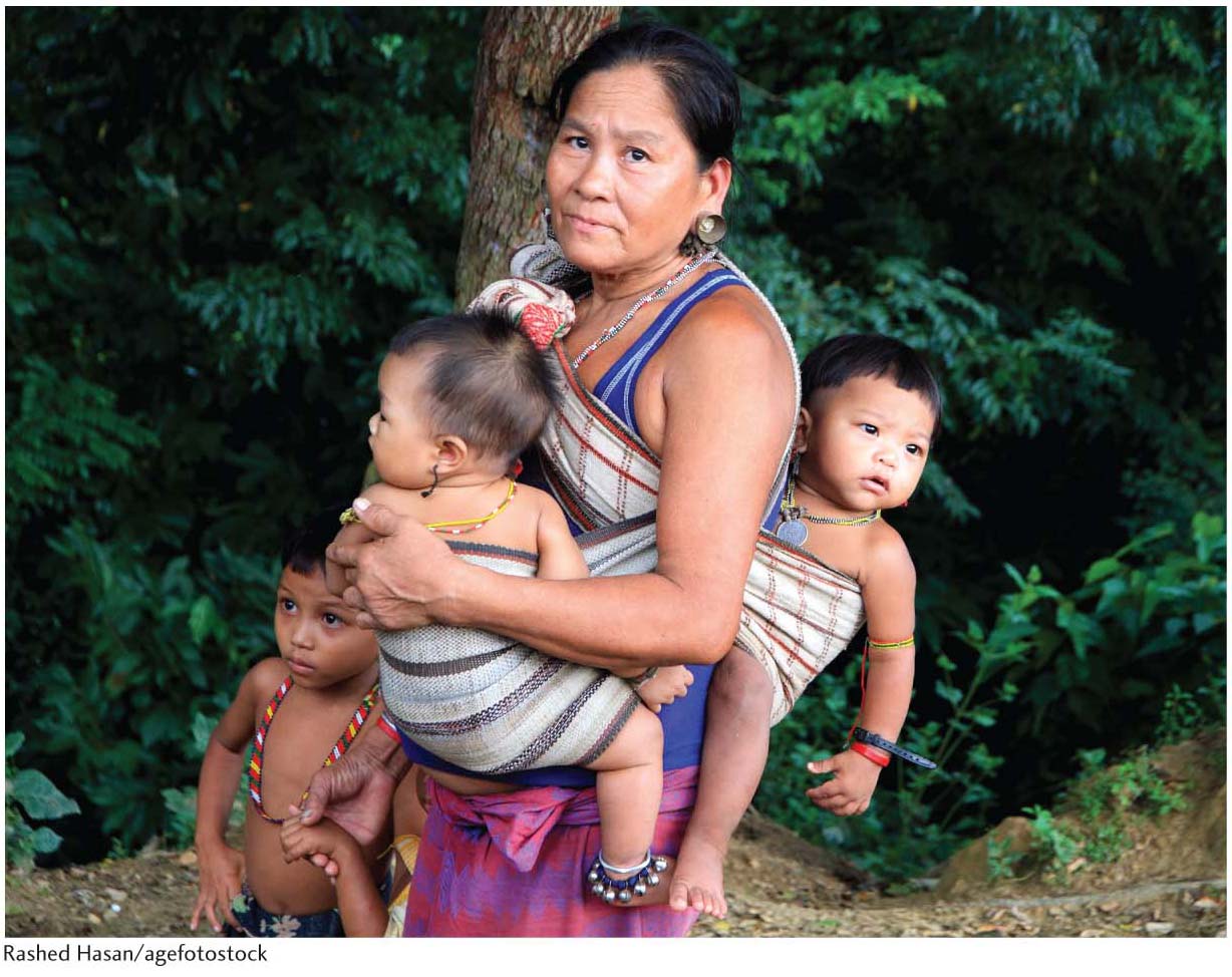
The so-called Hill Tribes of South Asia are another good example of the regional marginalization of indigenous peoples. Mountain ranges, including the Chittagong Hills, the Assam Hills, and the Himalayas, surround the fertile valleys and deltas around which the ancient South Asian Hindu and Islamic civilizations were centered. Various indigenous peoples occupy these highland regions, which are remote from the lowland centers of authority and culturally distinct from them (Figure 2.22). A series of indigenous culture regions ringing the valleys of South Asia thus exists, occupied by what the British colonial authorities referred to as Hill Tribes. Most of these peoples practice some version of swidden agriculture, which involves multiyear cycles of forest clearing, planting, and fallowing (see Chapter 8). Most hold Christian or animist beliefs (see Chapter 7) and speak languages distinct from those spoken in the lowlands. A similar pattern of highland indigenous culture regions can also be identified in the countries of Southeast Asia, such as Myanmar and Thailand, where indigenous peoples such as the Shan and Karen have populations in the millions.
55
56
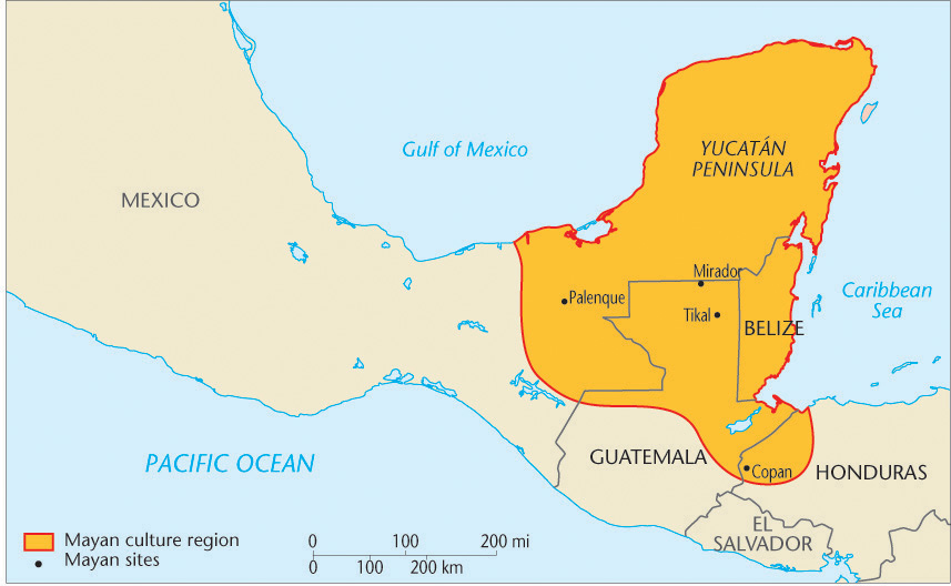
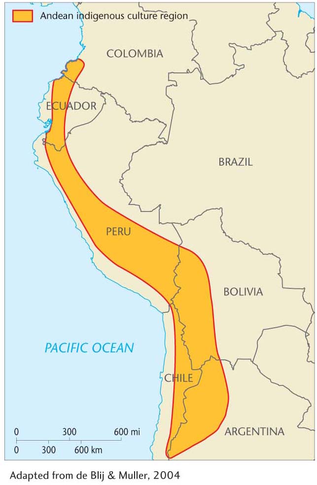
Indigenous culture regions also exist in Central and South America. There is a distinct Mayan culture region that encompasses parts of Mexico, Belize, Guatemala, and Honduras (Figure 2.23). Concentrations of Mayan speakers are especially common in rugged highlands and tropical forests. In South America, another concentration of indigenous peoples exists in sections of the Andes Mountains. This area constituted the geographic core of the Inca civilization, which thrived between 1300 and 1533 C.E. and incorporated several major linguistic groups under its rule. Today, up to 55 percent of the national populations of Andean countries, such as Bolivia, Peru, and Ecuador, are indigenous. On the slopes and in the high valleys of the Andes, Quechua and Aymara speakers constitute an overwhelming majority, signifying an indigenous culture region (Figure 2.24).
THE RISE OF THE LBGT DISTRICT
Sexuality, as with all aspects of human culture, is expressed geographically. One of the most dynamic developments in cultural geography over the past two decades has been the emergence of a new field of study on sexuality and space, referred to as queer geography (or sometimes gay geography). The emergence of queer geography as a field of study reflects and is reflected in the increasing acceptance of lesbian, bisexual, gay, and transgendered (LBGT) identities in popular culture.
57
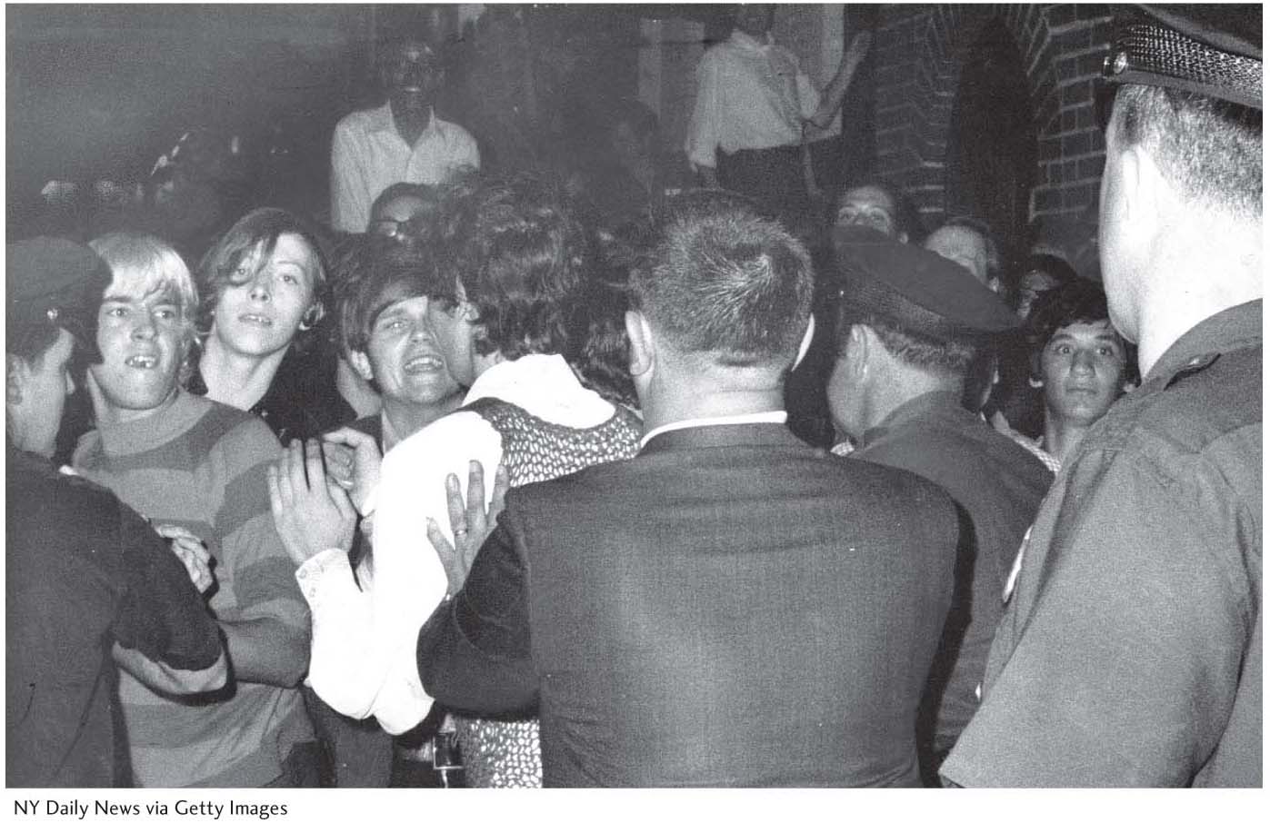
As geographers Larry Knopp and Michael Brown have noted, from the 1990s onward there has been an expanding interest in documenting the history of LBGT experience, most notably through a series of case studies of North American cities. These studies have coincided with a dramatic turnaround in popular attitudes toward sexualities that historically had been kept “in the closet.” That is, human sexuality that was different from a narrowly prescribed heterosexual norm was until recently repressed in public discourse and made invisible in the landscape (Figure 2.25).
58
An Attack on Equality
![]() An Attack on Equality
An Attack on Equality
http://www.tinyurl.com/mfj3e45
This video centers on an interview with two young victims of a hate crime against same-sex partners. The attack took place in daylight on a busy public street near Madison Square Garden. Such hate crimes, the video reports, are on the rise in New York City, despite the city’s reputation for tolerating diversity. The victims explain that the circumstances of the attack have caused them to reevaluate their ideas about New York City and its residents’ readiness to accommodate and defend cultural diversity. They conclude that the State of New York’s legalization of same-sex marriage has not meant the end of discrimination and violence against openly gay citizens.
Thinking Geographicaly:
Besides the hate crimes, what are some examples of unequal treatment of same-sex couples mentioned in the video? In particular, think about how same-sex couples may experience public space differently than heterosexual couples as a result of unequal treatment.
Sexuality, as one mode of cultural difference, is expressed geographically. How do the violent attacks discussed in the video help explain why so many cities have LBGT districts?
This chapter discusses the idea of place images. In the video, one person describes his childhood image of New York as “this dream metropolis” and “basically the Emerald City that I’ve always wanted to go to.” What do you think he meant by that? How do you think the attacks have altered the place image that fueled his move to New York?
Mapping LBGT culture is one way that “hidden” lives are made visible and unrecognized contributions to urban social life are acknowledged. In a Seattle-based study, Knopp and Brown set out to do just that. Using GIS mapping software, archived materials, and interviews with LBGT activists, they were able to reconstruct the geographic experience of LBGT residents of Seattle. They documented the location of a wide range of “gay-friendly” places, including bookstores, bars, theaters, and restaurants as well as the public spaces where LBGT residents felt comfortable to socialize. In addition, they used their findings to produce a map and poster that was exhibited at the city’s Gay Pride Festival, thereby highlighting the many LBGT contributions to the cultural, political and economic development of the city (Figure 2.26). Among Knopp and Brown’s other findings was that LBGT influence was strong throughout the city and not just confined to the widely recognized gay-friendly neighborhood of Capitol City.

59
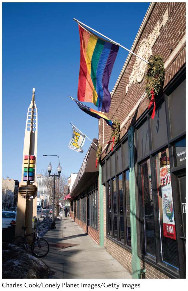
Neighborhoods such as Capitol City are so common across North America that a new terminology has grown to describe them. Known as a “gayborhood,” “gay village,” or simply, “LBGT district,” such urban spaces may be found in many major cities. As with numerous urban subcultures, LBGT residents have tended to cluster in neighborhoods where they feel comfortable among accepting or like-minded people and are able to live without hiding their sexual identity. Today, rather than try to suppress or hide such districts, local governments are celebrating them as part of the cultural diversity of their cities. Chicago’s “Boystown” is a good example. The city’s official marketing organization, Choose Chicago, features Boystown at its promotional web site under the theme of “Chicago Pride” in its neighborhoods. Boystown is described as the first officially recognized LBGT district in the United States, signified by the city’s installation of rainbow-colored Art Deco pillars to mark its borders (Figure 2.27). Local pride notwithstanding, Choose Chicago’s mission is to “sell” the city to tourists, business investors, and prospective homeowners. It is interesting to note how an LBGT district has suddenly gone from being hidden to being featured in one city’s official sales pitch.
60
VERNACULAR CULTURE REGIONS
A vernacular culture region is the product of the spatial perception of the population at large—a composite of the mental maps of the people. Such regions vary greatly in size, from small districts covering only part of a city or town to huge, multistate areas. Like most other geographical regions, they often overlap and usually have poorly defined borders.
vernacular culture region
A culture region perceived to exist by its inhabitants, based in the collective spatial perception of the population at large, and bearing a generally accepted name or nickname (such as “Dixie”).
Even though cadastral surveys (surveys that define the boundaries and subdivisions of public lands) and official atlases with official place names are the basis for modern governments and businesses, people all over the world still use vernacular references to navigate everyday life. In conversation, people will often say, “She lives over in the Valley” or “He opened a business near the Old West End” rather than reciting a city name or street address (Figure 2.28). Such terms are embedded in the thick cultural and historical knowledge of local daily life, which we take for granted until we move to a new city or country and have to learn our way around.
Official maps and GPS instruments are not much help, because vernacular regional boundaries are fuzzy and indefinite and often their vernacular names are not even included. Great Britain’s Ordnance Survey acknowledges that people navigate on a daily basis using a geography related to but distinct from the official maps. The Ordnance Survey is the government agency charged with surveying and mapping every aspect of the country. In the late 2000s it created the Vernacular Geography initiative. One project is to create an alternative name gazetteer whereby one could learn that “Spaghetti Junction” refers to the M6 Motorway Junction 6 in Birmingham (Figure 2.29). Another project links with geographers at the universities of Cardiff and Sheffield to gather geotagged data from the web, both by automatic means and online public surveys. The ultimate goal is to make vernacular regions and places more widely accessible so that, for instance, dispatchers for emergency responders can understand local descriptions of locations.

Not only are the boundaries of vernacular regions fuzzy, they are dynamic, changing as everyday perceptions of geography and identity transform. Geographer Shrinidhi Ambinakudige’s 2009 study revisited vernacular understandings of the U.S. “South” and “Dixie” first mapped in the 1970s and 1980s. Dixie is distinguished from the South because the terms convey different cultural meanings. Dixie is associated with the antebellum rural, plantation culture and the South with the more recent urbanizing and industrializing “new” South. Ambinakudige mapped the frequency of occurrence of business names that use one of these terms in the Yellow Pages. He found that over the past few decades, the boundaries of both regions are eroding, though Dixie is doing so at a much faster rate (Figure 2.30). Moreover, the strongest associations with Dixie and the South occur in rural areas, with metropolitan areas showing weakening associations. One explanation for the decline in Dixie and Southern identities, particularly in cities, is the large numbers of new residents migrating into the region from elsewhere. From this study we might generalize that vernacular regions are in flux, with established regions shrinking or expanding and new regions constantly coming into being.

61