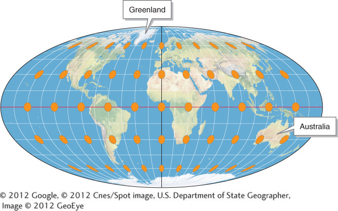
Mollweide equal-area projection. The orange circular areas are all approximately the same size and cover roughly the same geographic area no matter where on the map they are placed. This equalization of area is accomplished by compressing and distorting regions near the poles. Note that the orange areas at high latitudes become distorted ellipses compared with those at low latitudes. This equal-area map shows the true areas of Earth’s surface: note, for example, that Australia is over three times larger than Greenland. The Mollweide projection is used throughout Living Physical Geography.
(© 2012 Google, © 2012 Cnes/Spot image, U.S. Department of State Geographer, Image © 2012 GeoEye)