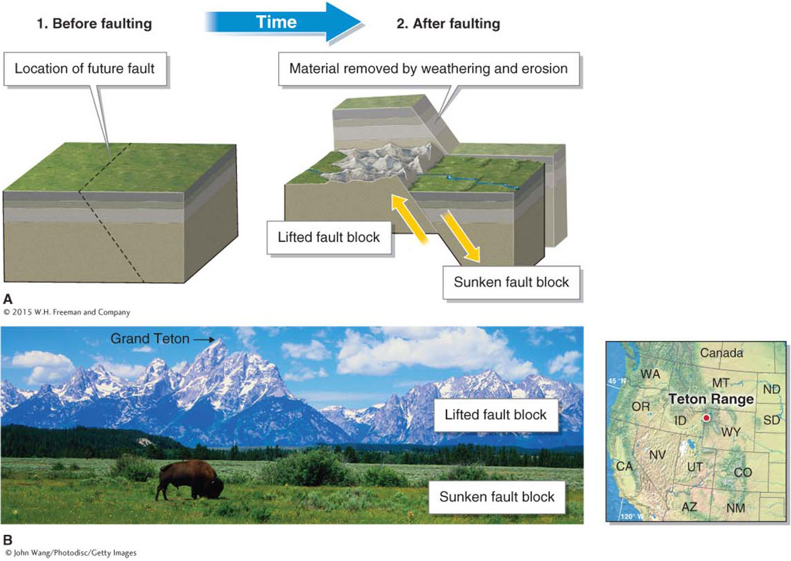
Figure 12.32
The Teton Range, Wyoming. (A) This diagram illustrates the fault block system that formed the Teton Range. The range formed when a 65 km (40 mi) long fault block was lowered, beginning about 13 million years ago. Erosion by streams and glaciers subsequently cut into the higher block, removing most of the overlying rocks and creating the jagged mountain topography seen today. (B) Grand Teton, standing at 4,197 m (13,770 ft) and visible here, is the highest peak in the Teton Range.(B. © John Wang/Photodisc/Getty Images)