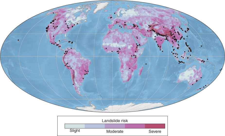
Figure 15.34
Global landslide risk. This map of landslide risk, which includes all types of ground movement, was made using satellite data and a GIS. To make the map, scientists analyzed slope steepness (steeper slopes have a higher risk), lanFigure 15.34
Global landslide risk. This map of landslide risk, which includes all types of ground movement, was made using satellite data and a GIS. To make the map, scientists analyzed slope steepness (steeper slopes have a higher risk), lan