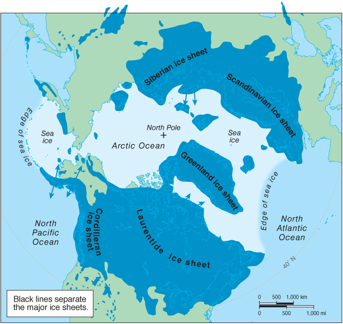
Figure 17.29
Ice sheets of the Wisconsin glaciation. During the Wisconsin glaciation, the Laurentide ice sheet and the Cordilleran ice sheet covered almost all of Canada and the northernmost United States. Northern Eurasia was covered by the Scandinavian ice sheet and the Siberian ice sheet. These ice sheets were up to 3 km (2 mi) thick. Because sea level was lower during the Wisconsin glaciation, Alaska was connected to Eurasia. This map does not show the changed shape of the continents at that time.