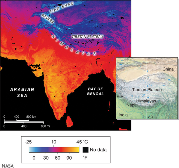
Figure 2.16
Land surface temperature and elevation. This satellite thermal infrared image shows average January land surface temperatures for South Asia during the period 200(NASA)
Figure 2.16
Land surface temperature and elevation. This satellite thermal infrared image shows average January land surface temperatures for South Asia during the period 200