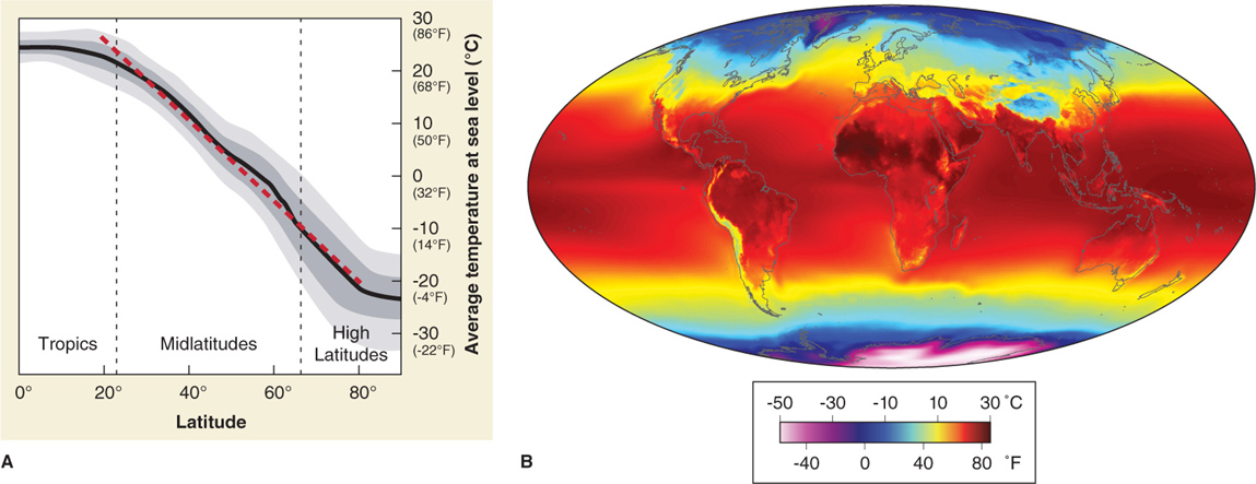
Figure 2.17
Latitude-temperature relationship. (A) For every 145 km traveled poleward, the average surface temperature (averaged here across both hemispheres) decreases 1°C (1°F per 50 mi) (red dashed line) between 20 and 80 degrees latitude. The effects of elevation have been removed from this graph. The gray areas show the potential variation around the observed average temperature (black line). (B) As a general rule, average annual temperatures are highest near the equator and decrease toward higher latitudes. Antarctica is colder than the Arctic because of ocean currents and the high elevation of the Antarctic ice sheet. Notice too that in mountainous areas at low latitudes, the effect of elevation prevails, lowering temperatures even on the equator. In some areas, such as the Sahara in northern Africa, temperatures increase away from the equator because the persistently cloudless skies at slightly higher latitudes result in intense sunlight.