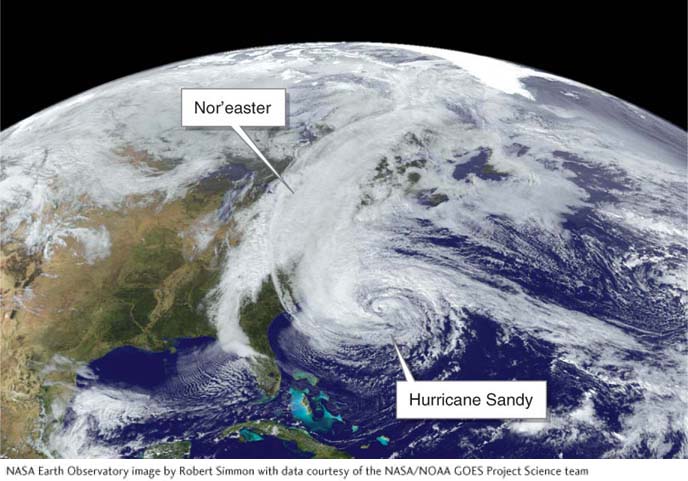
Figure 5.28
Superstorm Sandy, 2012. This satellite image of the East Coast of the United States captures the storm’s extent on the afternoon of October 28, 2012. The storm took over 286 lives, and its financial toll was some $68 billion. Because Hurricane Sandy combined with a nor’easter, the result was a particularly powerful storm.(NASA Earth Observatory image by Robert Simmon with data courtesy of the NASA/NOAA GOES Project Science team)