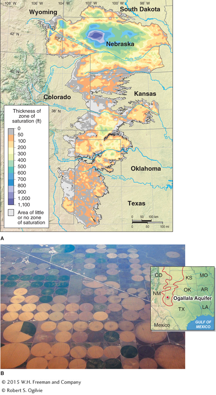
Figure 9.30
The Ogallala Aquifer. (A) The Ogallala Aquifer (as mapped in 2009) stretches from South Dakota to northern Texas. Its zone of saturation is thickest in Nebraska, where it is about 300 m (1,000 ft) thick. (B) This aerial photo shows the circular irrigation patterns produced by farms using the Ogallala Aquifer near the Texas Panhandle.(B. © Robert S. Ogilvie)