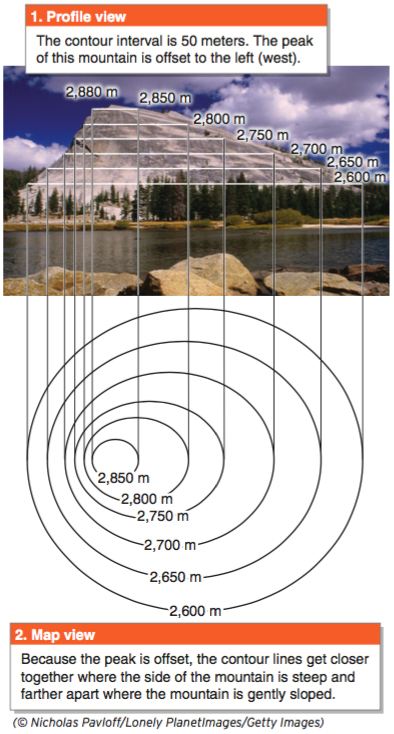
Figure GT.25
GEO-GRAPHIC: Contour lines on a steep slope. The base of Lembert Dome, in Yosemite National Park, is 2,600 m (8,528 ft) above sea level. The contour lines get closest together on its steepest slope. If you used the topographic map to plan a hike to the top of this mountain, you might decide that the side where the contour lines are farthest apart would be the easiest approach to the peak.(© Nicholas Pavloff/Lonely PlanetImages/Getty Images)