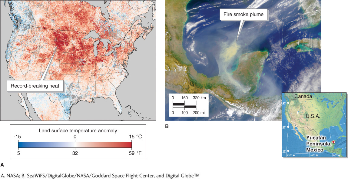
Figure GT.26
Satellite remote sensing. Satellite remote sensing is allowing scientists to monitor and study Earth’s physical systems in new ways. (A) This image shows the unusual weather in an eight-day period during March 2012. Summerlike ground surface temperatures replaced normally cold weather for much of the United States and Canada, and temperature records were broken at over 1,000 locations. Temperatures are given as anomalies above or below the average for the same eight-day period of March between 2000 and 2011. (B) This image shows dense smoke from fires pouring from the Yucatán Peninsula, Mexico, and into the Gulf of Mexico, April 24, 2000.(A. NASA; B. SeaWiFS/DigitalGlobe/NASA/Goddard Space Flight Center, and Digital Globe™)