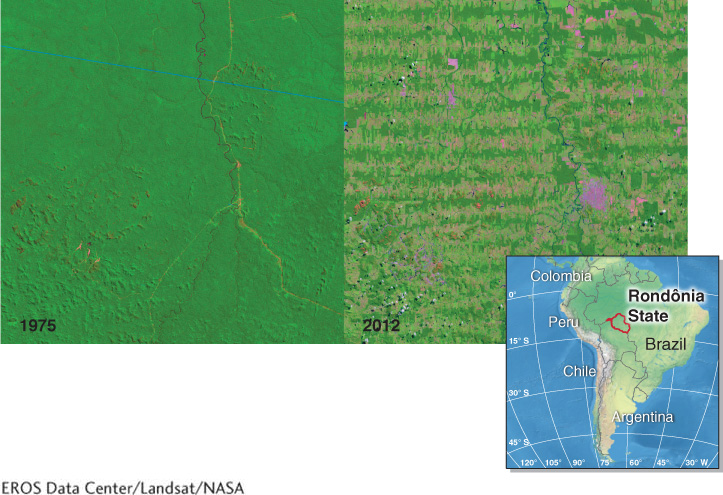
Figure GT.5
Rondônia deforestation. These satellite images show deforestation in Rondônia, Brazil, between 1975 (left) and 2012 (right). The two images show the same location. Dark green areas are covered by forest. Light green and purple areas in the 2012 image have been cleared. Logging, agriculture, and cattle ranching are driving deforestation in the Amazon rainforest. Both spatial and temporal scales are evident in this image. In only 37 years (the temporal scale), large expanses (the spatial scale) of tropical rainforest habitat have been lost. The distance across each image is about 40 km (25 mi).(EROS Data Center/Landsat/NASA)