APPENDIX 3 Topographic Maps
APPENDIX 3 Topographic Maps
Topographic maps, or “topo” (pronounced TOE-
Aerial photography and satellite imagery provide much of the data from which topographic maps are made. USGS topographic maps range in scale from 1:24,000 to 1:1,000,000 (see Section GT.3). The scale 1:24,000 is the most commonly used. Such maps represent 7.5 minutes of the geographic grid; they are therefore often referred to as 7.5 minute topos.
USGS topographic maps provide information about surface relief using contour lines. Human development, agriculture, waterways, glaciers, and vegetation are also shown on topographic maps. Figure A.5A shows a sample of a USGS topographic map of Crater Lake in Oregon, and Figure A.5B provides some of the symbols commonly used on topo maps.
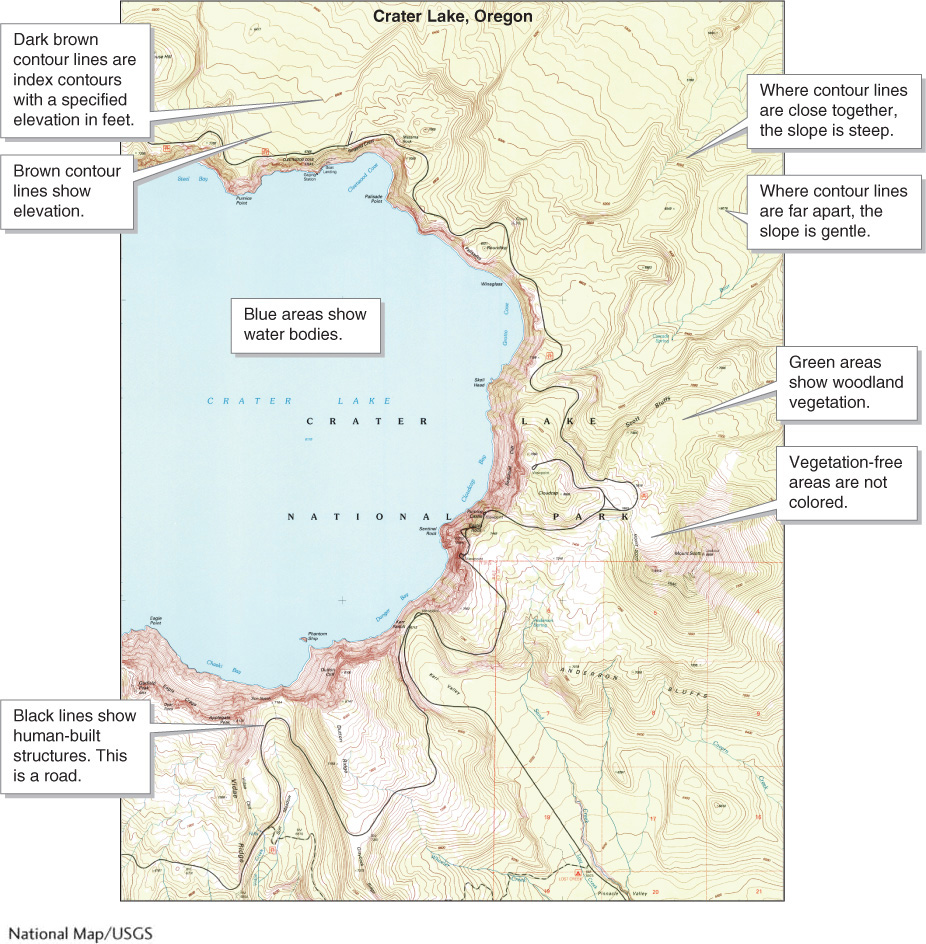
Figure A.5A
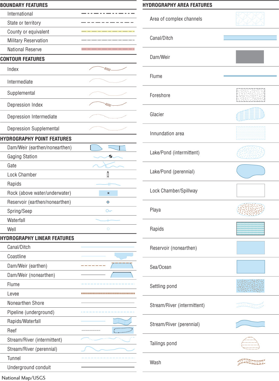
Figure A.5B
A-
A-