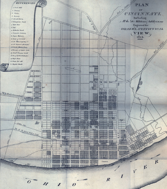
Plan of Cincinnati, 1815 This map, drawn four years before Cincinnati was incorporated as a city, illustrates the importance of the Ohio River to the city’s development. Nestled along the riverbank, the village of Cincinnati was laid out in a grid pattern. The map lists a steam mill; two breweries; ferries; a potash factory, sugar refinery, and sawmill; churches; banks; and other important locations. Courtesy Archives & Rare Books Library, University of Cincinnati