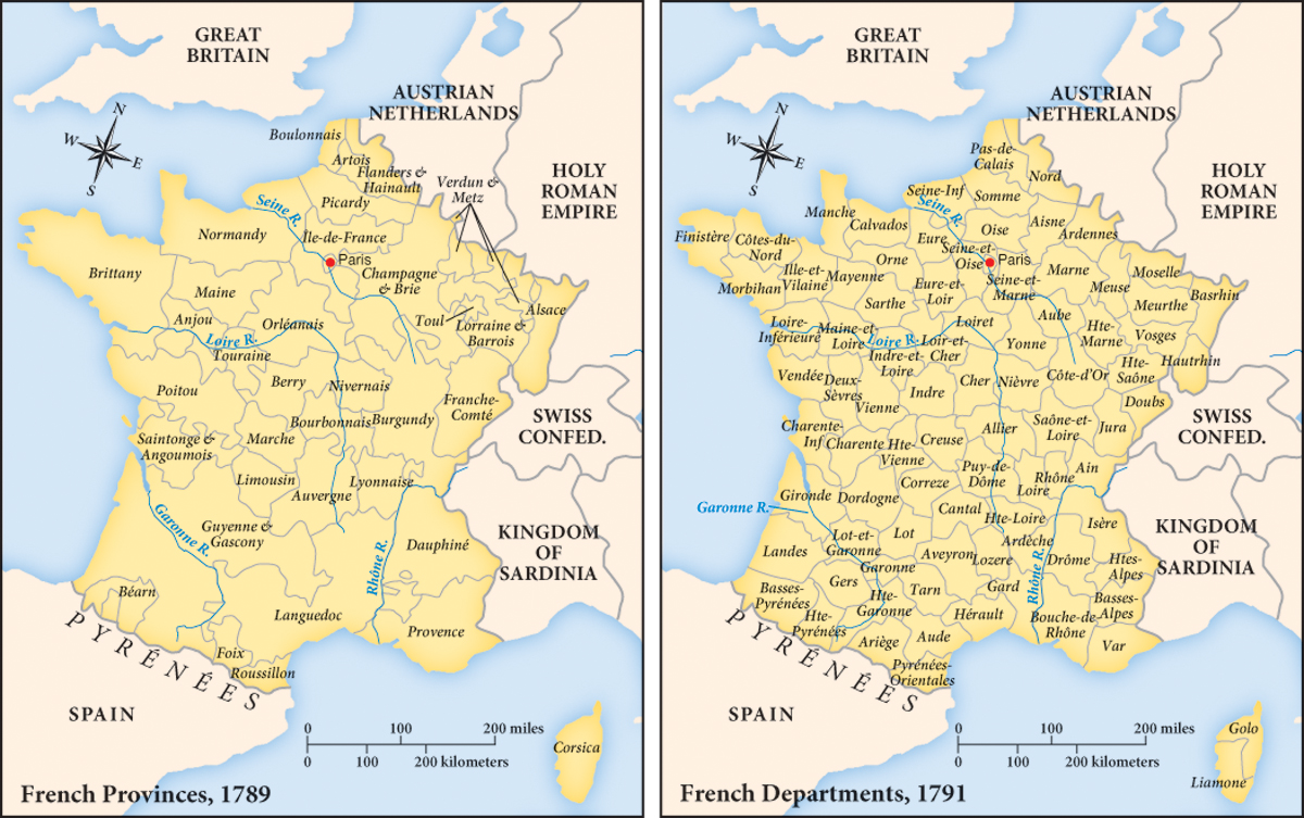
MAP 19.1 Redrawing the Map of France, 1789–1791
Before 1789, France had been divided into provinces named after the territories owned by dukes and counts in the Middle Ages. Many provinces had their own law codes and separate systems of taxation. As it began its deliberations, the new National Assembly determined to install uniform administrations and laws for the entire country. Discussion of the administrative reforms began in October 1789 and became law on February 15, 1790, when the Assembly voted to divide the provinces into eighty-three departments, with names based on their geographical characteristics: Basses-Pyrénées, Haute-Pyrénées, and Pyrénées-Orientales for regions containing the Pyrénées Mountains; Marne and Haute-Marne for areas containing the Marne River; and so on. How did this redrawing of the administrative map reflect the deputies’ emphasis on reason over history?