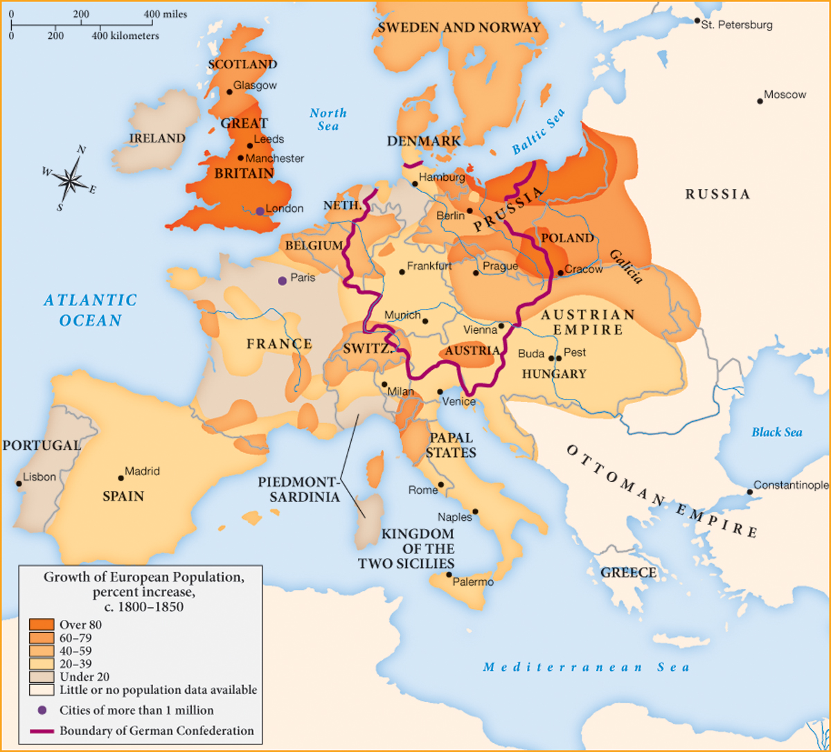
MAPPING THE WEST Europe in 1850
This map of population growth between 1800 and 1850 reveals important trends that would not otherwise be evident. Although population growth correlated for the most part with industrialization, population also grew in more agricultural regions such as East Prussia, Poland, and Ireland. Ireland’s rapid population growth in the early nineteenth century does not appear on this map because the famine of 1846–1851 killed more than 10 percent of the population and forced many others to emigrate.