Seeing History: Expanding Geographic Knowledge: World Maps in an Age of Exploration
On the eve of Christopher Columbus’s voyages, most Europeans knew that the world was round and many shared Columbus’s view that new routes to Asia and its riches could be found by sailing west. Beyond that, however, geographic knowledge of what precisely lay on the other side of the Atlantic was sketchy at best. Even those regions familiar to Europe through trade and exploration—Africa and parts of Asia—were often shown inaccurately on maps of the day.
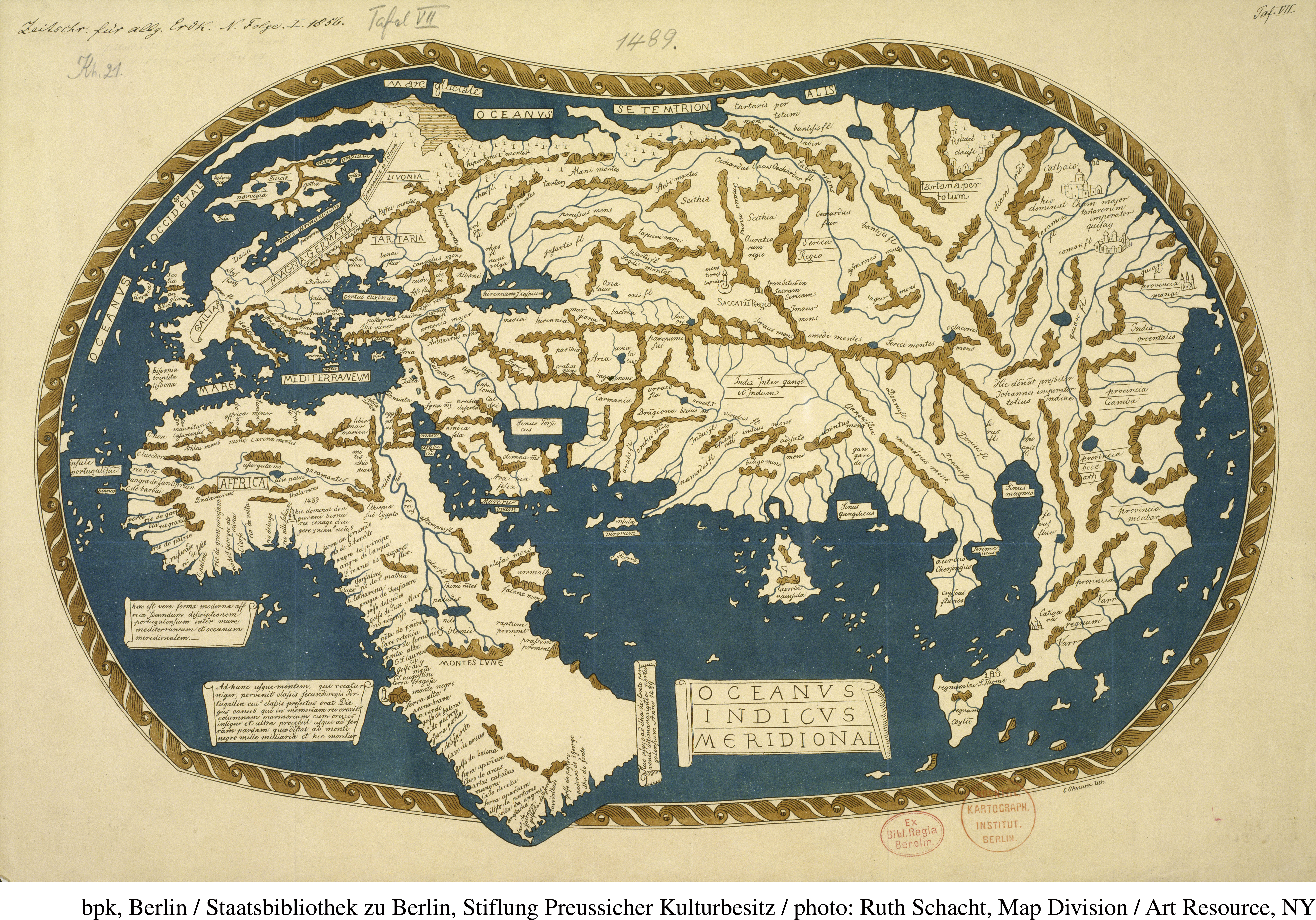
The hand-colored map at the top produced by a German geographer, Henricus Martellus, depicts the world as Europeans knew it just before Columbus’s first voyage. The map reflects the new knowledge of the West African coast gained by Portuguese explorers, but it does not include the Americas, which Europeans had not yet discovered.
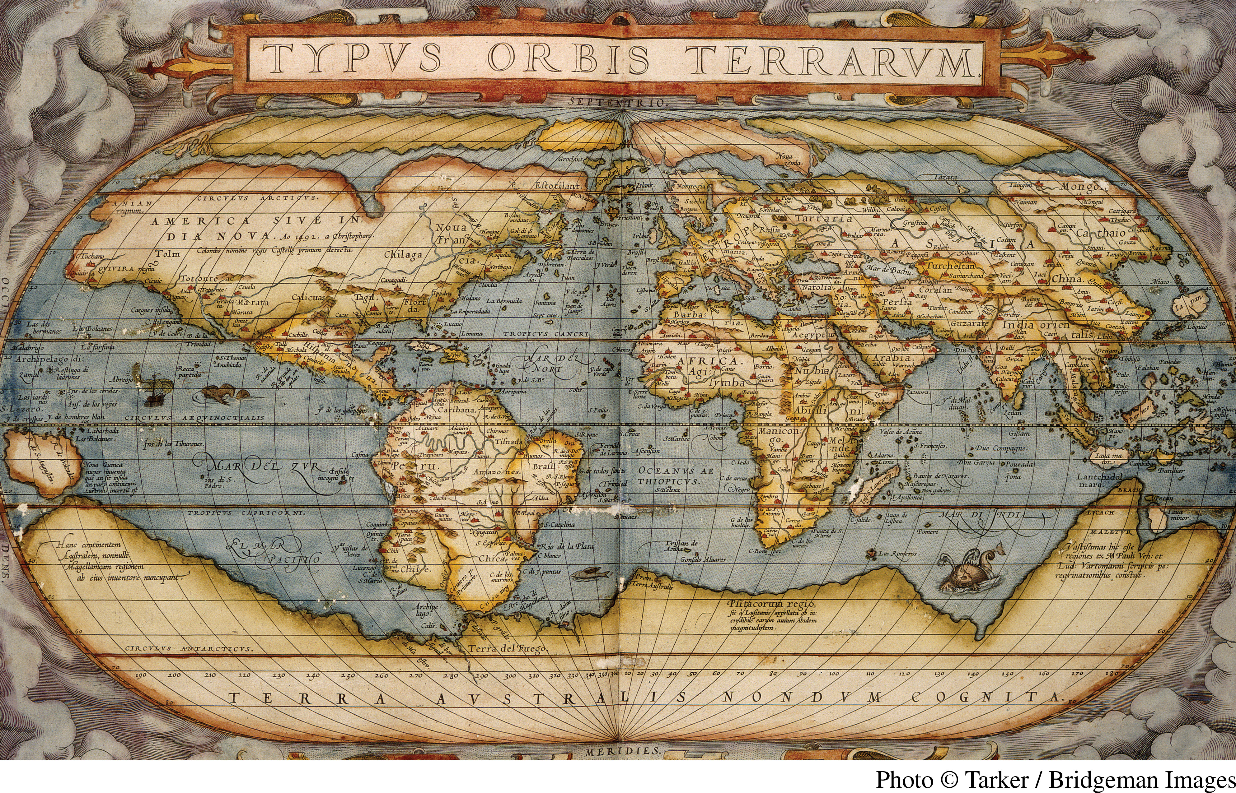
By 1570, when Abraham Ortelius’s map was printed, European knowledge of world geography had grown by leaps and bounds thanks to the voyages of exploration. Ortelius, a well-traveled and prominent geographer and cartographer, included this map in his Theatrum Orbis Terrarum (Theater of the World), considered to be the first modern atlas.
Questions to Consider
- How accurate is the Martellus map’s rendition of Europe, the Mediterranean, and Africa?
- How does the Martellus map help explain Columbus’s mistake about where he had landed in 1492?
- What new knowledge had been gained by the time of Ortelius and what impact did that knowledge have on Europeans?