Geography and Settlement
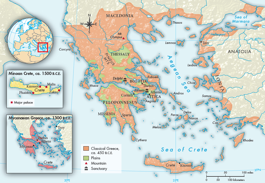
Hellas, as the Greeks still call their land, encompassed the Greek peninsula, the islands of the Aegean (ah-GEE-uhn) Sea, and the lands bordering the Aegean, an area known as the Aegean basin (Map 3.1). Geography acts as an enormously divisive force in Greek life; mountains divide the land, and although there are good harbors on the sea, there are no navigable rivers. Much of the land is rocky and not very fertile, which meant that food availability was a constant concern.
The major regions of Greece were Thessaly and Macedonia in the north, and Boeotia (bee-OH-shuh) and the large island of Euboea (YOU-boh-ee-ah) in the center, lands marked by fertile plains that helped to sustain a strong population capable of serving as formidable cavalry and infantry. Immediately to the south of Boeotia was Attica, an area of thin soil in which olives and wine grapes flourished. Attica’s harbors looked to the Aegean, which invited its inhabitants, the Athenians, to concentrate on maritime commerce. Still farther south, the Peloponnesus (peh-luh-puh-NEE-suhs), a large peninsula connected to the rest of mainland Greece by a very narrow isthmus at Corinth, was a patchwork of high mountains and small plains that divided the area into several regions. Beyond the coast, the islands of the Aegean served as stepping-stones to Anatolia.
The geographical fragmentation of Greece encouraged political fragmentation. Communications were poor, with rocky tracks far more common than roads. Early in Greek history, several kingdoms did emerge, but the rugged terrain prohibited the growth of a great empire like those of Mesopotamia or Egypt. Instead tiny states became the most common form of government.
MAP 3.1
Classical Greece, 500–338 B.C.E.In antiquity, the home of the Greeks included the islands of the Aegean and the western shore of Turkey as well as the Greek peninsula itself. Crete, the home of Minoan civilization, is the large island at the bottom of the map.