Technology and the Rise of Exploration
Technological developments in shipbuilding, weaponry, and navigation also paved the way for European expansion. Since ancient times, most seagoing vessels had been narrow, open boats called galleys, propelled largely by slaves or convicts manning the oars. Though well suited to the placid waters of the Mediterranean, galleys could not withstand the rough winds and uncharted shoals of the Atlantic. The need for sturdier craft, as well as population losses caused by the Black Death, forced the development of a new style of ship that would not require much manpower to sail. In the course of the fifteenth century, the Portuguese developed the caravel, a small, light, three-mast sailing ship. Though somewhat slower than the galley, the caravel held more cargo. Its triangular lateen sails and sternpost rudder also made the caravel a much more maneuverable vessel. When fitted with cannon, it could dominate larger vessels.
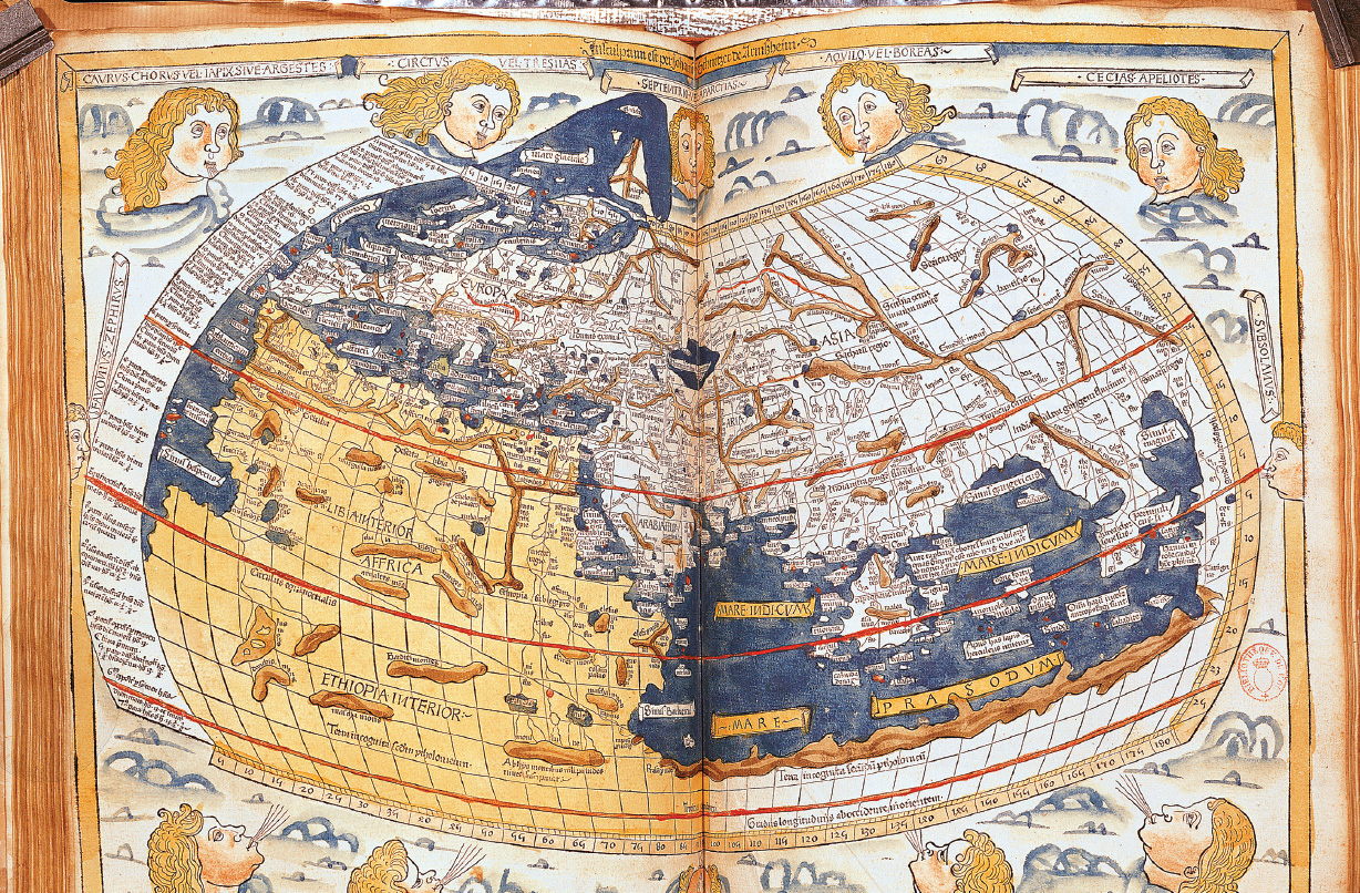
Great strides in cartography and navigational aids were also made during this period. Around 1410 Arab scholars reintroduced Europeans to Ptolemy’s Geography. Written in the second century C.E. by a Hellenized Egyptian, the work synthesized the geographical knowledge of the classical world. Ptolemy’s work provided significant improvements over medieval cartography, clearly depicting the world as round and introducing the idea of latitude and longitude to plot position accurately. It also contained crucial errors. Unaware of the Americas, Ptolemy showed the world as much smaller than it is, so that Asia appeared not very distant from Europe to the west. Based on this work, cartographers fashioned new maps that combined classical knowledge with the latest information from mariners. First the Genoese and Venetians, and then the Portuguese and Spanish, took the lead in these advances.
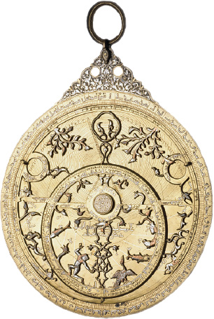
The magnetic compass enabled sailors to determine their direction and position at sea. The astrolabe, an instrument invented by the ancient Greeks and perfected by Muslim navigators, was used to determine the altitude of the sun and other celestial bodies. It permitted mariners to plot their latitude, that is, their precise position north or south of the equator.
Like the astrolabe, much of the new technology that Europeans used on their voyages was borrowed from the East. Gunpowder, the compass, and the sternpost rudder were Chinese inventions. The lateen sail, which allowed European ships to tack against the wind, was a product of the Indian Ocean trade world. Advances in cartography drew on the rich tradition of Judeo-Arabic mathematical and astronomical learning in Iberia. Sometimes assistance to Europeans came from humans rather than instruments. The famed explorer Vasco da Gama employed a local Indian pilot to guide his expedition from the East African coast to India. In exploring new territories, European sailors thus called on techniques and knowledge developed over centuries in China, the Muslim world, and the Indian Ocean.