image
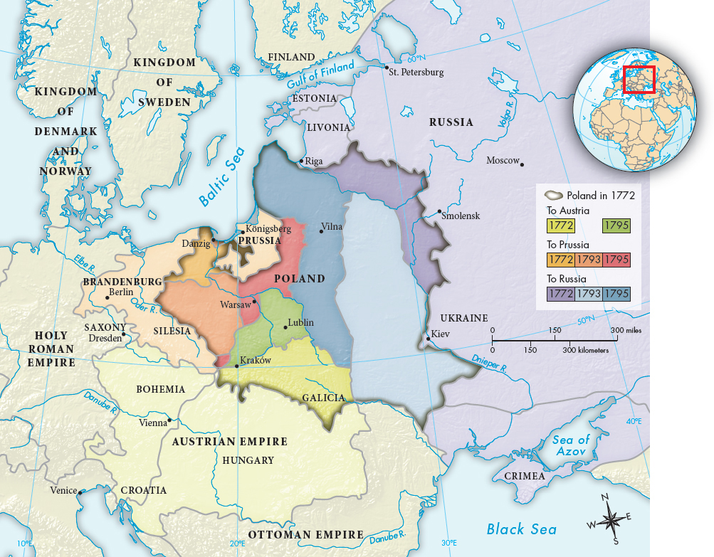
MAP 19.1The Partition of Poland, 1772–1795In 1772 the threat of war between Russia and Austria arose over Russian gains from the Ottoman Empire. To satisfy desires for expansion without fighting, Prussia’s Frederick the Great proposed dividing parts of Poland among Austria, Prussia, and Russia. In 1793 and 1795 the three powers partitioned the remainder, and Poland ceased to exist as an independent nation.> MAPPING THE PASTANALYZING THE MAP: Of the three powers that divided the kingdom of Poland, which benefited the most? How did the partition affect the geographical boundaries of each state, and what was the significance? What border with the former Poland remained unchanged? Why do you think this was the case?CONNECTIONS: Why was Poland vulnerable to partition in the later half of the eighteenth century? What does it say about European politics at the time that a country could simply cease to exist on the map? Could that happen today?