image
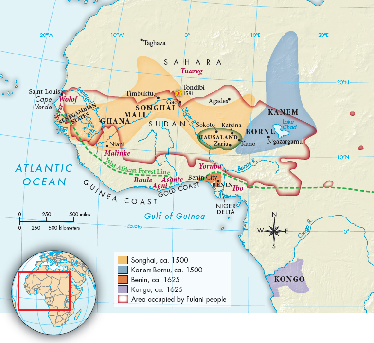
MAP 20.1West African Societies, ca. 1500–1800The coastal region of West Africa witnessed the rise of a number of kingdoms in the sixteenth century.> MAPPING THE PASTANALYZING THE MAP: What geographical features defined each of the kingdoms shown here? Consider rivers, lakes, oceans, deserts, and forests. How might they have affected the size and shape of these kingdoms?CONNECTIONS: Compare this map to the spot map of the slave coast of West Africa (see “The Transatlantic Slave Trade”). Consider the role that rivers and other geographical factors played in the development of the West African slave trade. Why were Luanda and Benguela the logical Portuguese sources for slaves?