MAJOR MARINE ENVIRONMENTS
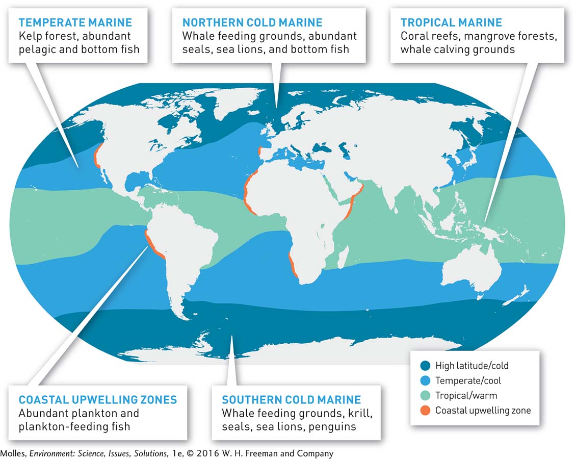
FIGURE 8.4 Average ocean temperature defines the major marine environments. Boundaries between marine environments were mapped in the Northern Hemisphere using a February thermal image and in the Southern Hemisphere using an August thermal image. (National Virtual Oceanographic Data System [NVODS], http:/