6.4 Humans already use most of the world’s accessible freshwater supplies

Should water be used for growing crops in the desert that might be grown elsewhere?
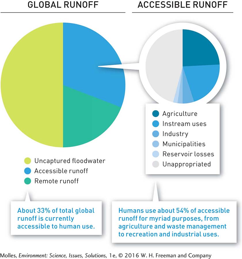
Even though the total amount of freshwater flowing down mountainsides and into rivers and lakes should be enough to meet our global needs, much of it is not practical to access. Half of all surface runoff each year occurs during heavy rains and flows straight out to the sea. Another fifth of Earth’s freshwater runoff occurs in remote, sparsely populated regions. The Amazon River in South America and the Congo River in Africa carry a large fraction of the world’s freshwater runoff, but there’s no easy way for humans to make use of it. This leaves about one-
irrigation A system for artificially delivering water to crops so that they can grow in areas with too little precipitation to support them otherwise.
instream uses Benefits, such as dilution of sewage and recreational fishing and boating, that result from water flowing in river or stream channels.
Currently, humans use more than half of this accessible runoff. The largest fraction of this, more than 20%, is for crop irrigation, a system for artificially delivering water to crops so that they can grow in areas with too little precipitation to support them otherwise. The next largest fraction of accessible runoff is used for diluting sewage and other wastes, maintaining rivers as shipping channels, providing for recreation, and sustaining fish populations. We call these instream uses, that is, uses within the river or stream channel. Industries and municipalities combined use about 10% of accessible runoff. Finally, a little more than 2% of accessible runoff is lost through evaporation from flood control and water storage reservoirs (Figure 6.8).
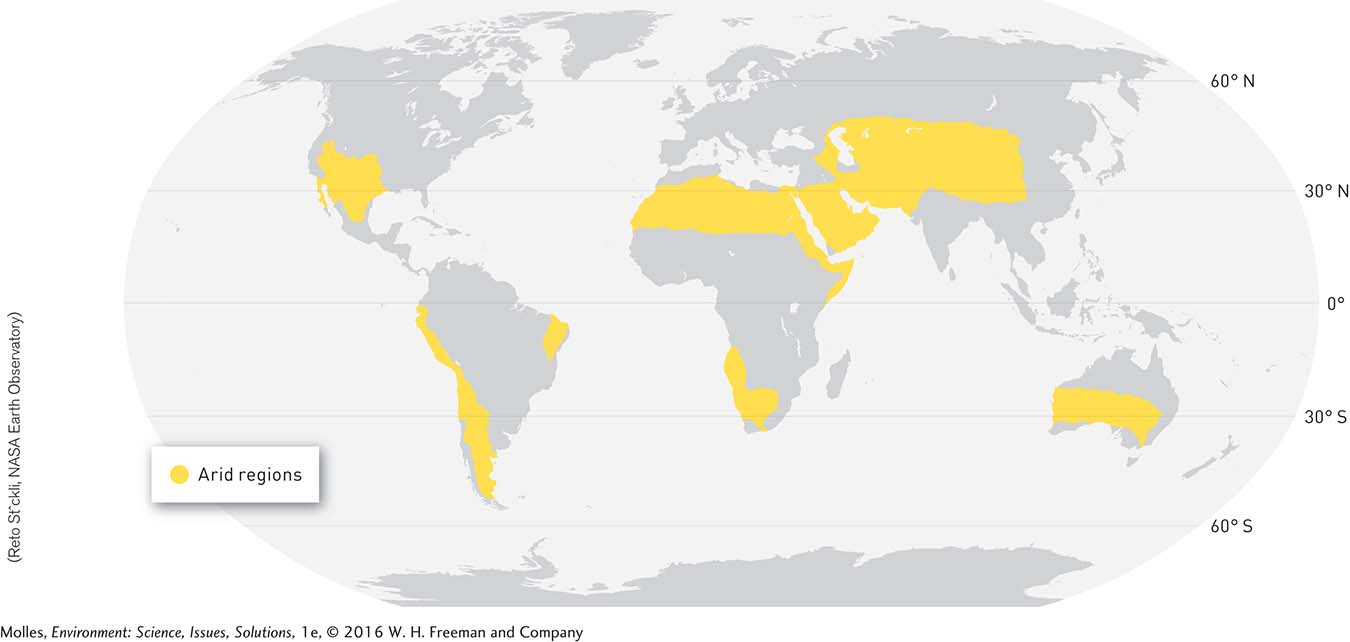
Arid Regions Have Maxed Out Their Water Supplies
dam A structure that blocks the flow of a stream or river; may be used to reduce downstream flooding or to store water in a reservoir.
Arid and semi-
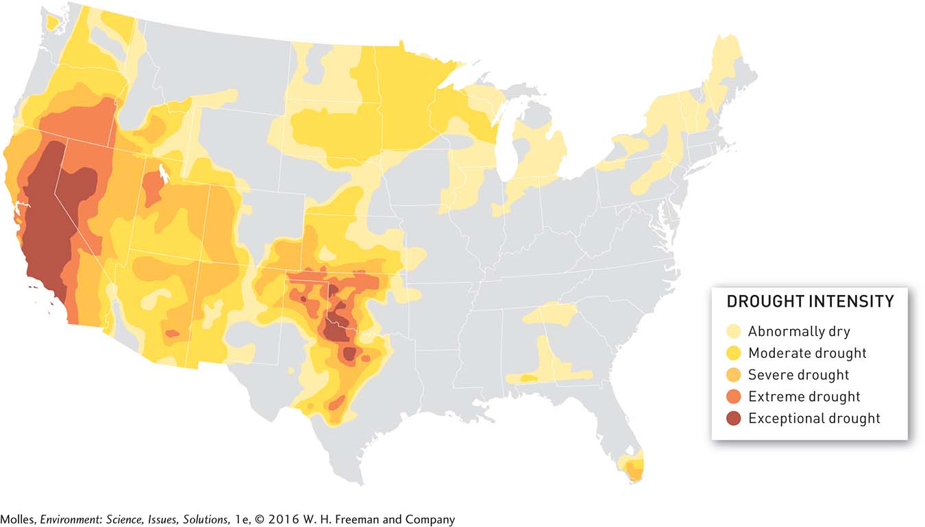
Droughts and Floods Make Water Planning Difficult
flood A river or stream overflowing its banks and inundating the surrounding landscape known as the floodplain.
floodplain The area of land that stretches from a water channel to the valley walls.
drought An extended period of dry weather during which precipitation is reduced sufficiently to damage crops, impair the functioning of natural ecosystems, or cause water shortages for human populations.
A flood occurs whenever a river or stream overflows its banks and inundates the part of the surrounding landscape called the floodplain, the area of land that stretches from the water channel to the valley walls. The higher portions of the floodplain may be flooded once per century or even less frequently. Though they deliver abundant water, floods may damage water supply systems, including dams, diversions, and pipelines, as well as contaminate drinking water supplies. At the other extreme, a drought is an extended period of dry weather that damages crops, impairs the functioning of natural ecosystems, and causes water shortages for human populations. When the weather cycles between the extremes of flood and drought, it is often difficult to deliver enough water to cities and farms in different parts of the country (Figure 6.10).
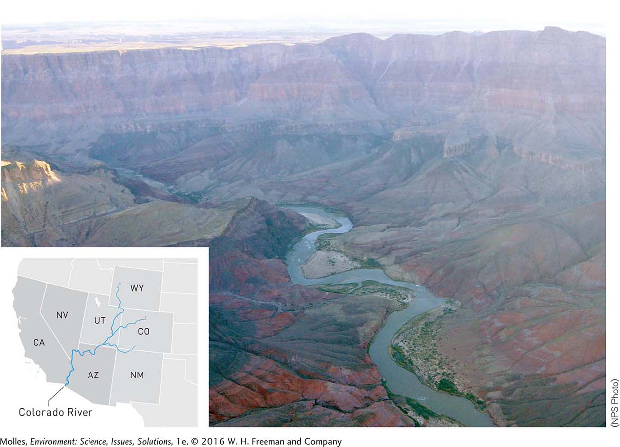
Colorado River Basin
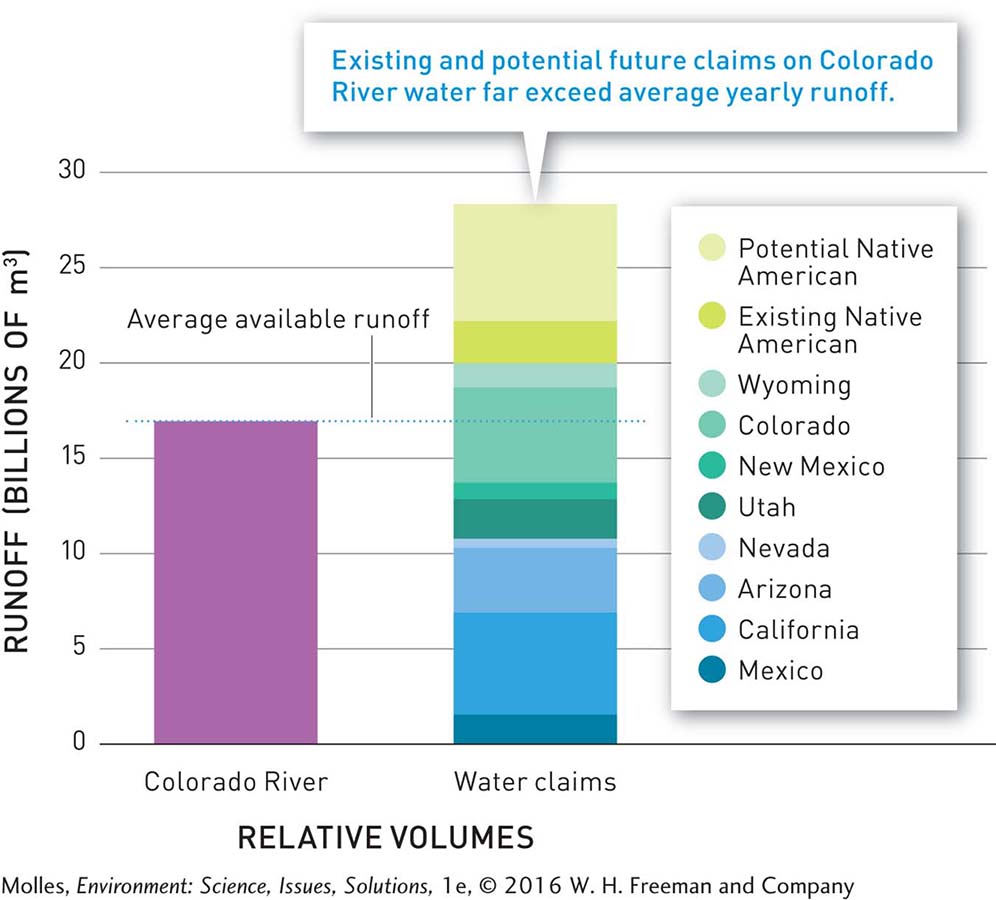
The Colorado River Basin encapsulates the challenges created by drought cycles and water shortages in arid regions. At the beginning of the 20th century, the Colorado River, which drains an area of nearly 650,000 km2, or about 8% of the 48 contiguous United States, was a wild river, little modified by human activity or structures. Today, 265 dams greater than 5 meters in height interrupt the flow of the Colorado River, making it possible to provide water for millions of people living over a vast area (Figure 6.11). This system supplies water for people living in seven U.S. states and two states in Mexico, including irrigation water for approximately 1.5 million hectares (3.7 million acres) of farmland and water to support the estimated 25 million people living in the region. The Colorado River has become so heavily drawn upon that it now rarely reaches the Gulf of California.
165
166
How would you allocate the water of the overappropriated Colorado River flow?
A complex combination of legal documents, including international treaties, regulates the appropriation of water within the basin among the affected U.S. states, Native American tribes, and Mexico. Because early appropriations were based on estimates of average runoff that were made during an unusually wet period in the Colorado River Basin, there is a disparity between supply and allocation (Figure 6.12). Conflicts over these limited water supplies are expected to increase with the growing population in the region and continued climate change.
Think About It
It is clear that water supplies in the historically water-
scarce regions of the world are becoming even more stretched. What are the options for water management in these regions? Water is removed from the Colorado River to supply the needs of arid areas such as Las Vegas, Nevada, and southern California. Critique this transfer of water, including both the pros and cons.