6.5 Groundwater is being depleted faster than it is replenished
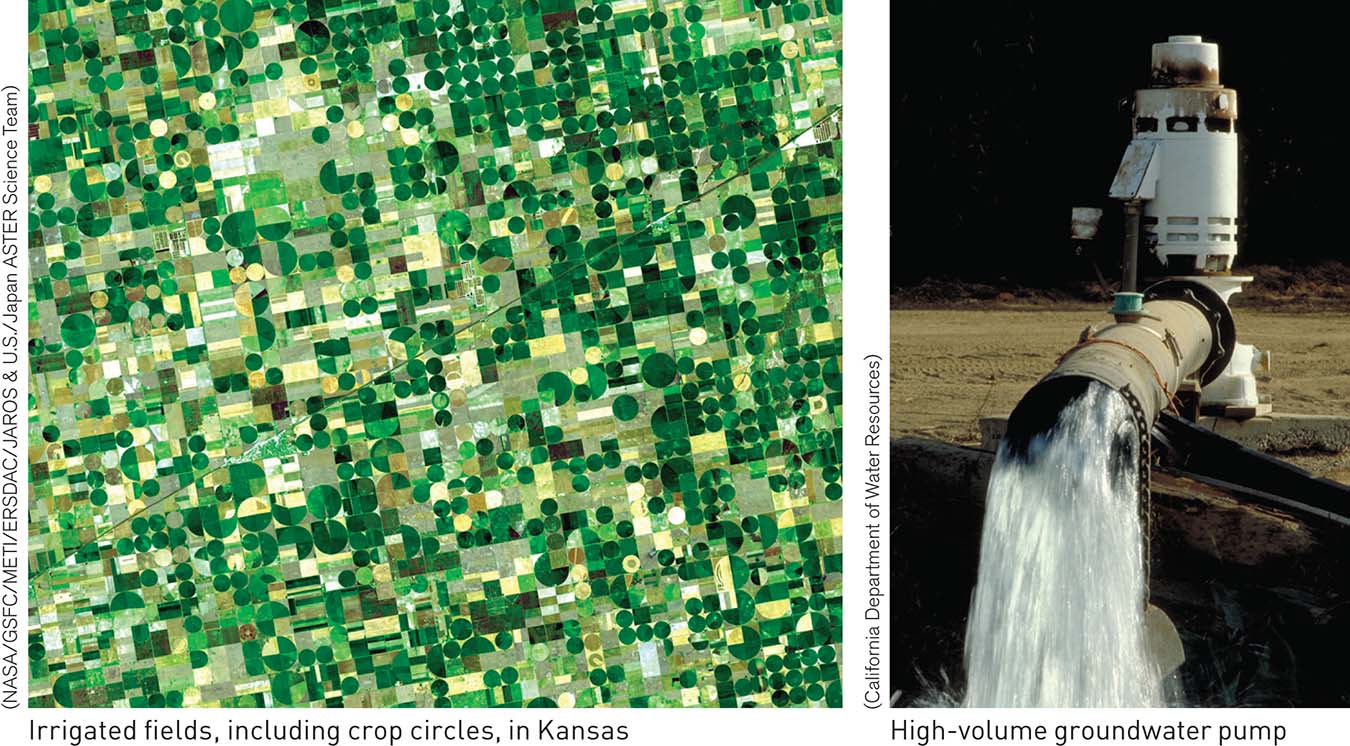
When there is no easily accessible runoff, people drill wells and tap into the groundwater. Approximately one-
167
The problem is that while groundwater deposits are vast, approximately three-
Ogallala Aquifer
In the United States, some of the most productive farmland in the High Plains depends on a massive groundwater resource, the Ogallala Aquifer. This aquifer underlies approximately 450,000 km2 (174,000 mi2) of the High Plains, more than the combined areas of Nebraska and Kansas. Pumping of water from the Ogallala Aquifer began mainly after the 1940s, when farmers began to drill deep wells into the aquifer, with the number of wells increasing rapidly to approximately 170,000 by 1978. From 1949 to 1978, the yearly amount of water pumped from the Ogallala increased from 4.9 km3 to 28.4 km3. That’s nearly twice the average yearly flow of the Colorado River during the 20th century.
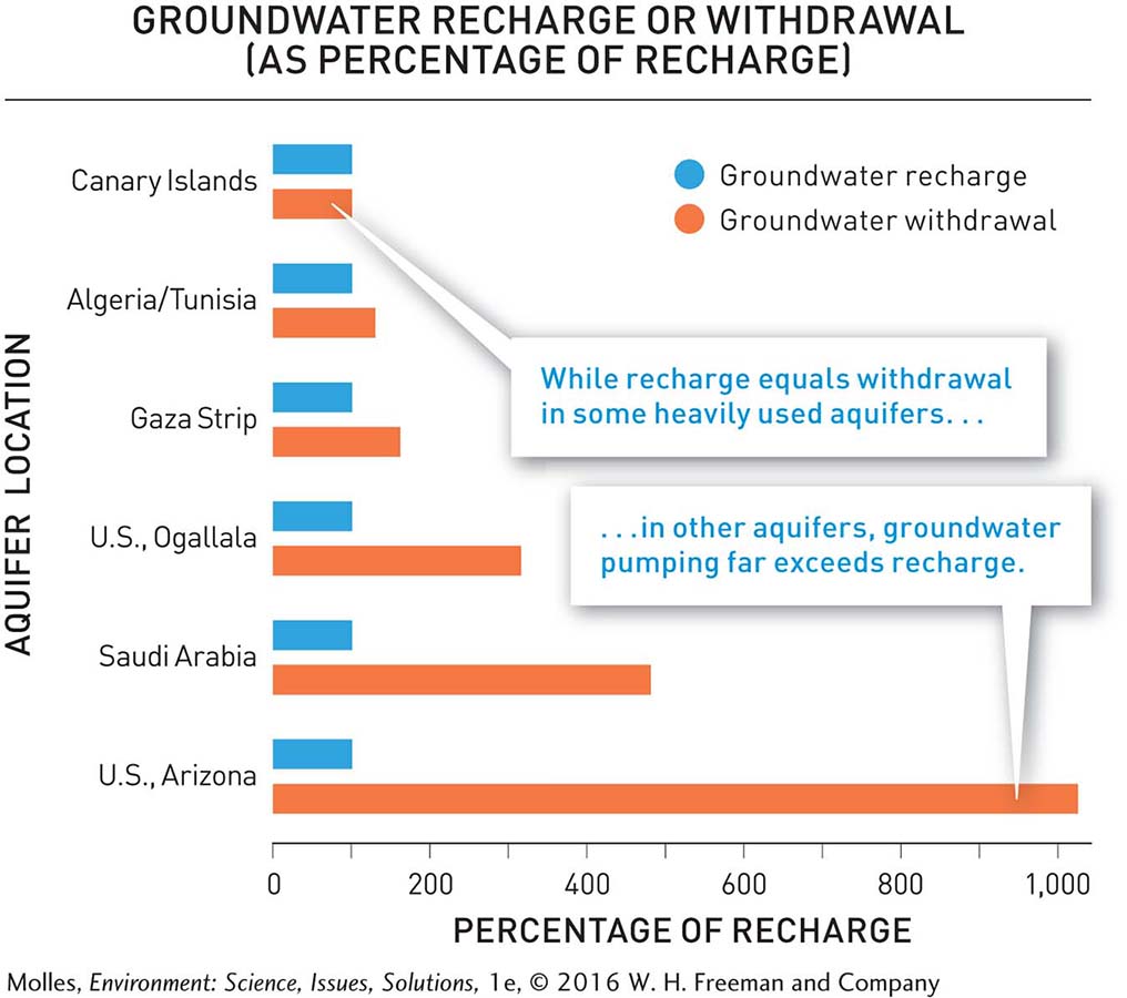
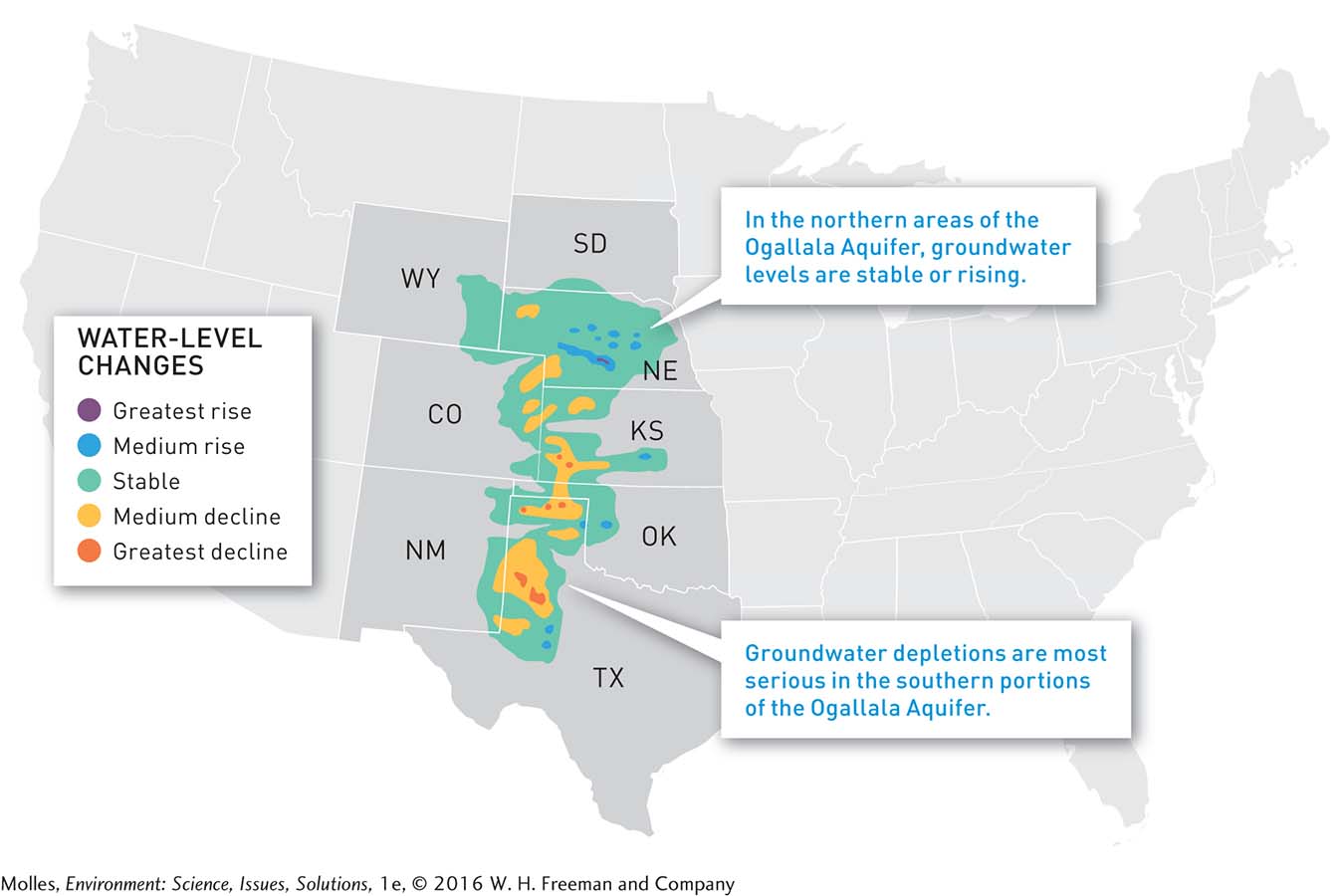
Unfortunately, the rate of withdrawal is approximately 2.5 times greater than the annual recharge rate (see Figure 6.14). As a result, the water table across the Ogallala Aquifer has dropped an average of 4.3 meters (14 feet). In some areas, such as Texas and Kansas, the water table has dropped more than 30 meters (100 feet). As a result of the imbalance between rates of groundwater pumping and recharge, the Ogallala aquifer may run out of water within a century (Figure 6.15). We discuss changes in agricultural practice that could greatly increase the expected life of the Ogallala Aquifer in Chapter 7 (see page 220).
168
Subsidence and Depletion
subsidence A settling or sudden sinking, in the case of sinkhole formation, of a land surface as a result of processes such as groundwater withdrawal or loss of organic matter in soil.
One common physical consequence of excessive groundwater withdrawal is subsidence of the overlying land surface into the spaces left as water is pumped out. Such subsidence can substantially reduce the storage capacity within the aquifer and damage surface structures in rural and urban areas alike. The U.S. Geological Survey estimates that an area in the United States roughly the size of New Hampshire and Vermont has been impacted by subsidence. Particularly dramatic and sudden subsidence occurs in Florida, with the appearance of house-
groundwater depletion
The amount of groundwater pumped from an aquifer in excess of recharge. Groundwater depletion can result in land subsidence, which reduces the capacity of an aquifer to store water and can damage buildings and other infrastructure.
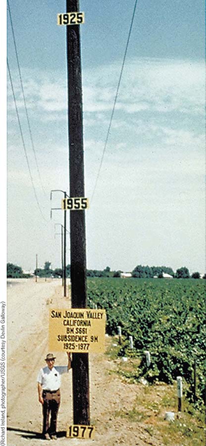
The highest rates of groundwater depletion and land subsidence in the United States in recent years have occurred in California’s San Joaquin Valley. Faced with an epic drought, farmers in the San Joaquin Valley were pumping massive amounts of groundwater to compensate for the lack of water in storage reservoirs. In response, water tables in some parts of the valley fell 60 meters (200 feet) in just two years, and land was subsiding at the unprecedented rate of 30.5 centimeters (1 foot) per year. This rate of subsidence was greater than even the historic extent of land sinking in the San Joaquin Valley (Figure 6.16). An unsustainable reliance on groundwater is a global-
Think About It
In response to the severe drought of the 1930s, many farms in Nebraska and elsewhere in the Great Plains were abandoned. By contrast, many fewer farms were abandoned during the 1950s drought. Why?
Based on Figure 6.15, which regions drawing water from the Ogallala Aquifer appear to be closest to using it sustainably? Which are using it at the least sustainable rate?