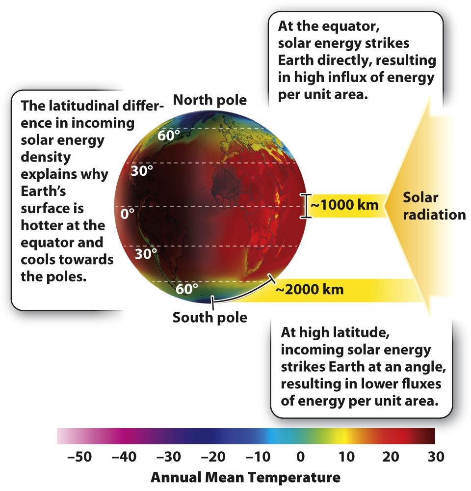
The principal control on Earth’s surface temperature is the angle at which solar radiation strikes the surface.
From the perspective of our solar system, Earth stands out as the planet with life. Our nearest neighbors, Venus and Mars, differ in being respectively too hot for liquid water to persist and too cold. Earth is the Goldilocks planet: just the right distance from the sun so that, in conjunction with the greenhouse effect of the atmosphere, solar radiation maintains surface temperatures that can keep water in its liquid form. As we look across Earth, we see that climate varies markedly from one region to another. This variation also reflects the relationship between Earth and the sun, modified by the physical features of Earth and the circulation of air and seawater.
Fig. 48.1 shows how mean annual temperature is distributed across Earth’s surface. At first glance, we see that Earth is hot near the equator and cold at the poles. This temperature distribution is a result of incoming solar radiation. Sunlight strikes equatorial regions directly, but, at higher latitudes, Earth’s surface is tilted at an angle to incoming radiation. To see what a difference this makes, shine a flashlight directly on a sheet of paper placed perpendicular to the beam of light. Now, tilt the paper at 45 degrees to the light. You’ll notice that the same amount of light (and so the same amount of energy) is now distributed over a larger area. On Earth, the amount of solar energy striking a given area in the tropics is about twice that found near the poles, and so tropical regions are warmer.
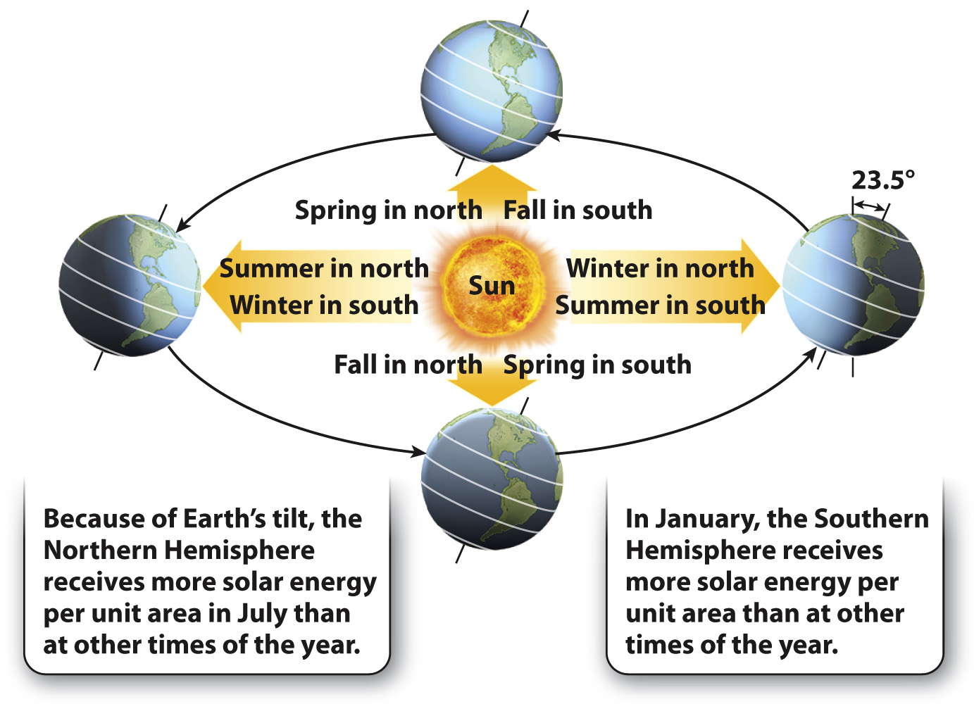
At higher latitudes, temperature is not only lower, it also exhibits greater variation through the year. Seasonality reflects a second feature of Earth as a planet: Earth’s axis of rotation is not oriented perpendicular to incoming sunlight but rather tilts at an angle of 23.5 degrees (Fig. 48.2). Because of this tilt, solar radiation strikes North America and Europe more directly in July than it does in January—
Quick Check 1 How would climates be different if Earth’s axis of rotation were perpendicular to incoming solar radiation, rather than tilted at 23.5 degrees?
Quick Check 1 Answer
Climates would not show strong seasonality.
Topography, or the physical features of Earth, also contributes to global temperature patterns. Mountaintops can be glaciated, even at low latitudes, reflecting the fact that temperature declines with increasing elevation. In general, temperature drops about 4°F for every 1000 feet in elevation (6.5°C per kilometer). Mountains therefore exhibit a pattern in which climate and biomes change as elevation increases, mirroring the spatial pattern from lower to higher latitudes.