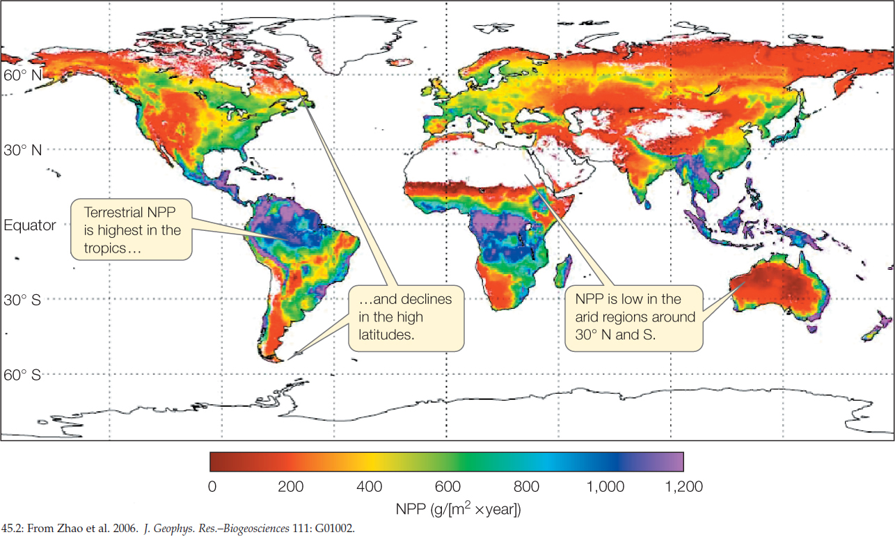
Figure 45.2: Terrestrial NPP Corresponds to Climate This map of estimated terrestrial NPP is based on satellite sensor data accumulated over the period 2000–2005. The white spaces on land represent unvegetated areas, including barren deserts and ice caps.