1.4 What Does All This Have to Do with Geography?
The first sentence for the entry “geography” in The Dictionary of Human Geography describes geography as “the study of the Earth’s surface as the space within which the human population lives.” To simplify a definition further into words of one syllable, geography is not just “where things are” but the study of “why things are where they are.” Geography deals with concepts of the spatial characteristics of our planet, and the spatial relationships and interactions of the people and features that occupy it. The notion of “Geographic Information Science” has been acclaimed for years as the study of the multiple concepts that surround the handling of spatial data, and today the use of geospatial technologies is tightly interwoven with the discipline of geography. See Hands-on Application 1.6: The Geospatial Revolution Will Be Televised for several examples of geospatial technologies being used for solving geographic problems.
At the higher education level, courses in GIS, remote sensing, GPS, and various applications of these technologies are key components of a geography curriculum. Certificate programs in Geographic Information Science (GISci) or Geospatial Technologies are also being increasingly offered by colleges and universities. Geospatial degree programs at the bachelor’s, master’s, or doctoral level have been developed at numerous universities (see Chapter 15 for more information about geospatial technology in education). Even in basic activities like collecting data in the field for a class project or producing a map of results, geospatial technologies have become an integral part of the geography discipline.
In a 2004 article, Jack Dangermond, CEO of the Environmental Systems Research Institute, Inc. (Esri; see Chapter 5), heralded GIS as a way of “Speaking the Language of Geography,” and in a 2009 article noted that GIS was seen as “Geography in Action.” Both of these are great descriptions—for example, when you use an in-vehicle navigation system to navigate your way through unfamiliar territory or use an online tool to examine housing values for your neighborhood, you’re using basic geographic concepts of space and place through technology. Geospatial technology gives us the tools to more easily apply location-based principles to real-world situations. For example, how is the new freeway bypass going to affect the local community regarding traffic flows, new commercial development, and individual properties? Or what are the potential impacts of the site chosen for a new casino development in relation to land use, economic and social effects, and the draw of gamers from far outside the local area? Throughout this book, you’ll be dealing with geospatial technology concepts and applications, using some sort of geospatial data, measuring spatial characteristics, or examining spatial relations.
!geo! HANDS-ON APPLICATION 1.6
The Geospatial Revolution Will Be Televised
Penn State University’s Geospatial Revolution Project showcases a series of excellent videos that detail how geospatial technology affects our everyday lives, especially when it comes to concerns such as monitoring climate change and disease tracking. Point your Web browser at http://geospatialrevolution.psu.edu and watch the available videos. There are additional videos aimed at a K-12 audience (but also present relevant information for all education levels) in the For Educators section as well.
Expansion Questions:

Question
E10FKHj0swsUAR9HX7Z7x1iZyzXhdxaaePtUzbF9tdmvxVpdrWIVrjC7lGKvcQRuoa7A9ERR0249i0zJizboCjIJ/Bn4nWHrCDusaNNWXksT5i2dBnpqbLGvmrdDst+Y-
Question
SImgnMtz8FlLvjs7ByfiuIkibJYsWCmvVehxI078Z4cQyl3MkNXw9iRB1g05zUQRePskfFysn3SJvJy3S+5lN8ijz8ar6eLKYbMB1GmvRCWXoG364ObDJbUMcZ69QoDmniOv/kFzXF9N3SzWxRUPbd/jVYuoTD6fLHOm9js3/wDoLeZn011fVYb6sZ8=
13
One of the most welcome recent developments is the opportunity for people without geospatial training to get involved in this field by applying their geographic knowledge. With geospatial tools becoming more widely utilized, people now have the chance to create their own geospatial content. Whether they’re creating new maps, updating existing maps, tying digital pictures to locations on a map, or adding to geocaching databases, more and more people are using geospatial technologies to add to or enhance geospatial data and knowledge. Dr. Michael Goodchild coined the term volunteered geographic information (VGI) to give a name to data generated in this way.
VGI volunteered geographic information, a term used to describe user-generated geospatial content and data
wiki a database available for everyone to utilize and edit
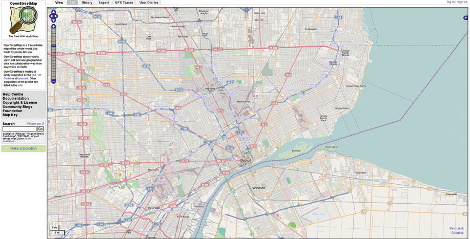
A wiki is a Web utility that allows users to freely create, manage, update, and change the content of a Website. Possibly the best known one is Wikipedia, an online encyclopedia that anyone can edit. By extending this wiki concept to geospatial data, individuals can contribute their own maps, images, and updates to geospatial content available on the Internet, thereby generating VGI. Websites such as Google Map Maker or OpenStreetMap (see Figure 1.8 and Hands-on Application 1.7: User-Generated Geospatial Content Online for more information) are dedicated to the VGI principle of users generating or contributing to the geospatial content they contain. For example, Google Map Maker allows users to contribute to the content of Google Maps by adding places, locations, and hiking trails, or by helping to improve on directions given by the system. After all, who would know more than you about new businesses that have opened, new roads that have been put in, or local hiking trails in your area? By contributing your geographic knowledge to sources like Google Map Maker or OpenStreetMap, you’re helping to build an extensive database of geospatial content as well as improving available online resources used by others.
14
!geo! HANDS-ON APPLICATION 1.7
User-Generated Geospatial Content Online
Volunteered Geographic Information (VGI) represents user-generated geospatial content online. Use your Web browser to investigate some of these sites (and see how your own local area is represented with each one):
- Google Map Maker: http://www.google.com/mapmaker
- MapQuest Open: http://open.mapquest.com
- OpenStreetMap: http://www.openstreetmap.org
- Wikimapia: http://wikimapia.org
Expansion Questions:
-
Question
Sqc56xYhlrIu3ZbgkLpP+47EFF/6GmxhEimIN5yJ9IYup/CPD0wGldOmWZu579itCGMIyyuPG+P+ojPIMUNhR1FAsj2v3MEcZ39P8V2l6lQTs8/qjg8w0OsvmU6rPBTtc3T5X4XyPtqtE68n8CurX1eV7aDXpmx3 -
Question
qtLCmQ5Scx+9foFvvTpWoCmgcWg+QN2p9O+ZNvFCBoX81PxyNrEFN8I1owDAlcDmMoJLy8drPO5IqS7SgnkAx6/FyDoOGTzuXUlrxvy7qH6k7ZDBoPtkuT5YClmm+Hhd68sWjLGZghNa3/uW+Gn8+ciUZbuPjibQg9Pp84SrdTWGWMFiK2biuALciOJPfh56ZhGvEv9chqqgXaUMPqaU7brWdGU3QlyF75lIvojpaWvdDk1a4nsAZO89dHq/befQaY0nnbsshZjrLRjGYILLTmsPDeiC+2DKyqf8QhxxtpCTWqIFEc8OpUXRxvsqv+KJ95sGFyEK6wI=
crowdsourcing the activities of untrained volunteers to create content and resources which can be utilized by others
It’s becoming easier to apply geographic principles using geospatial technologies. For instance, on May 4, 2012, The Saugerties Times published a call for volunteers to take part in the launch of a free smartphone app for mapping the spread of invasive species, and explained that the collected data would be utilized in a New York invasive species database. Activities like these are referred to as crowdsourcing, in which the contributions of untrained volunteers (often referred to as citizen scientists) collect data, content, or observations as part of a larger project. Geospatial technologies are enabling everyone to become involved with collecting and analyzing geographic data. There are many free geospatial technology apps and software packages available today, and a widely used example is Google Earth.