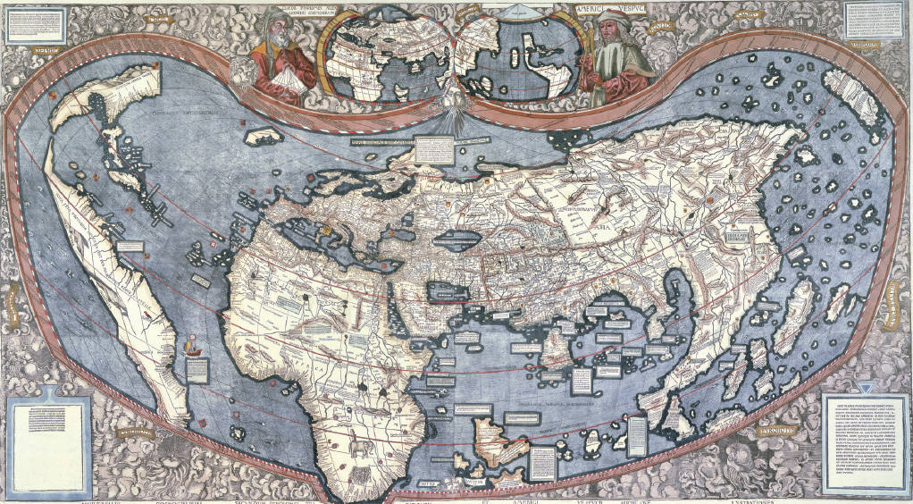
The Waldseemüller Map of 1507 Just fifteen years after Columbus landed in the Western Hemisphere, this map, which was created by the German cartographer Martin Waldseemüller, reflected a dawning European awareness of the planet’s global dimensions and location of the world’s major landmasses. (bpk, Berlin/Staatsbibliothek zu Berlin, Stiftung Preussischer Kulturbesitz, Berlin, Germany/Ruth Schacht, Map Division/Art Resource, NY)