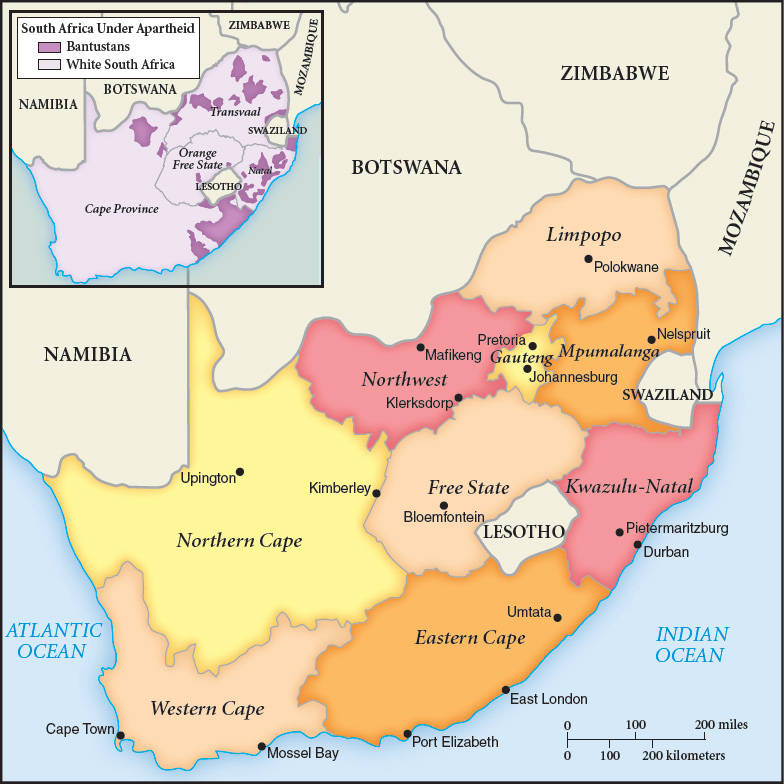
Map 22.3 South Africa after Apartheid Under apartheid, all black Africans were officially designated as residents of small, scattered, impoverished Bantustans, shown on the inset map. Many of these people, of course, actually lived in white South Africa, where they worked. The main map shows the new internal organization of the country as it emerged after 1994, with the Bantustans abolished and the country divided into nine provinces. Lesotho and Swaziland had been British protectorates during the colonial era and subsequently became separate independent countries, although surrounded by South African territory.