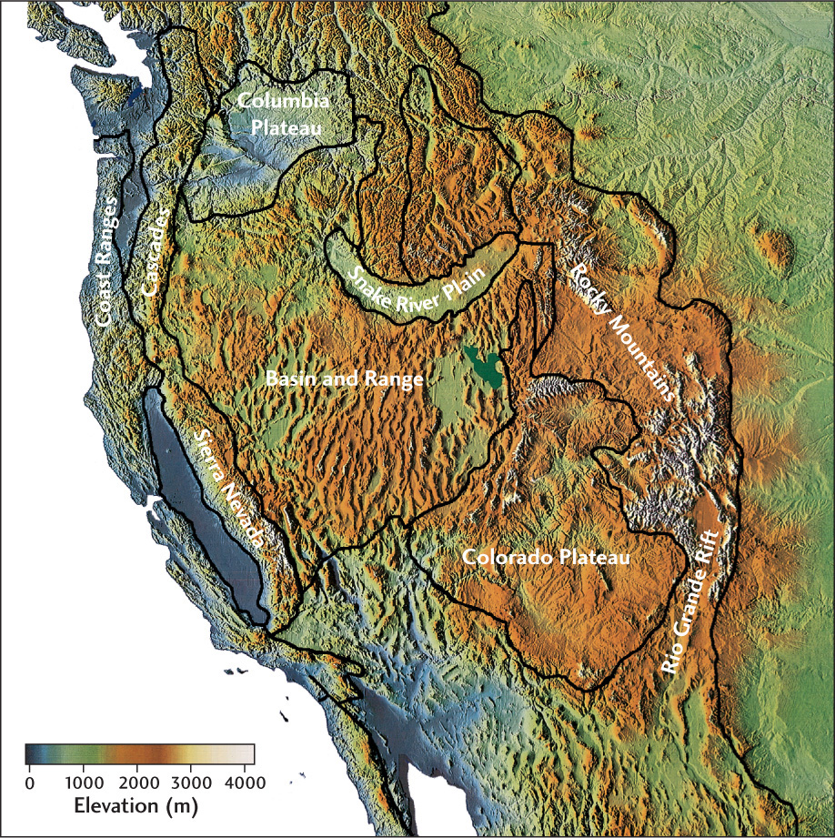
Figure 10.5Topography of the North American Cordillera in the western United States. Computer manipulation of digitized elevation data produced this color shaded relief map. The major tectonic provinces of the area are clearly visible, as if illuminated by a light source low in the west.