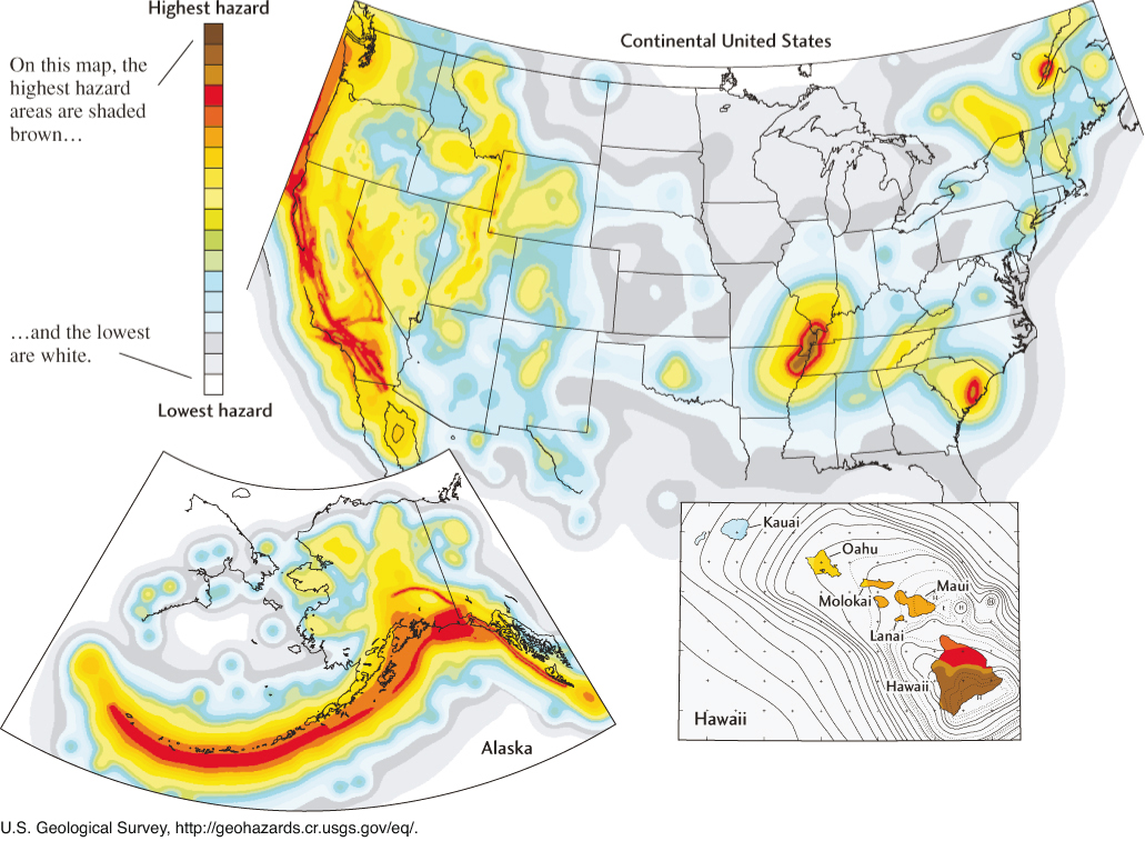
Figure 13.26Seismic hazard map for the United States. The regions of highest hazard lie along the plate boundaries of the West Coast and Alaska and on the southern side of the Big Island of Hawaii. In the central and eastern United States, the areas of highest hazard are near New Madrid, Missouri, and Charleston, South Carolina; in eastern Tennessee; and in portions of the Northeast.