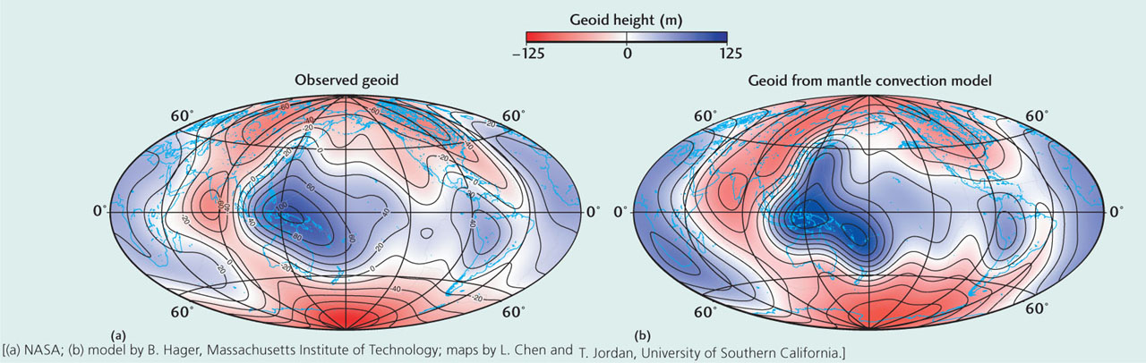
A smoothed map of the geoid, or “shape of Earth,” derived from satellite observations. The contours, given here in meters, show how the observed sea level deviates from that on an ideal Earth without any lateral variation in rock density. (b) A map of the geoid computed from a model of mantle convection that is consistent with the temperature structure of the mantle derived from seismic tomography. By matching the observed geoid with such theoretical models, geologists have improved their understanding of the mantle convection system.