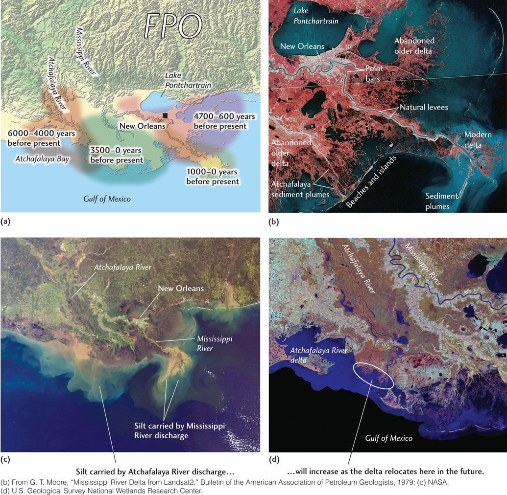
Figure 18.19Over the past 6000 years, the Mississippi River has built its delta first in one direction and then in another as water flow has shifted from one major distributary to another. (a) The modern delta was preceded by deltas deposited to the east and west. (b) The infrared-sensitive film used to record this satellite image of the Mississippi delta causes vegetation to appear red, relatively clear water to appear dark blue, and water with suspended sediment to appear light blue. At the upper left are New Orleans and Lake Pontchartrain. Well-defined natural levees and point bars can be seen at the center. At the lower left are beaches and islands that formed as ocean waves and currents transported river-deposited sand from the delta. (c) Satellite photograph of the Mississippi delta. (d) This image shows the discharge of sediment into the Gulf of Mexico from the Mississippi River delta and the Atchafalaya River. A major flood could divert the main flow of the Mississippi into the Atchafalaya, causing a new delta to form. Construction of artificial levees by the Army Corps of Engineers has prevented this so far.