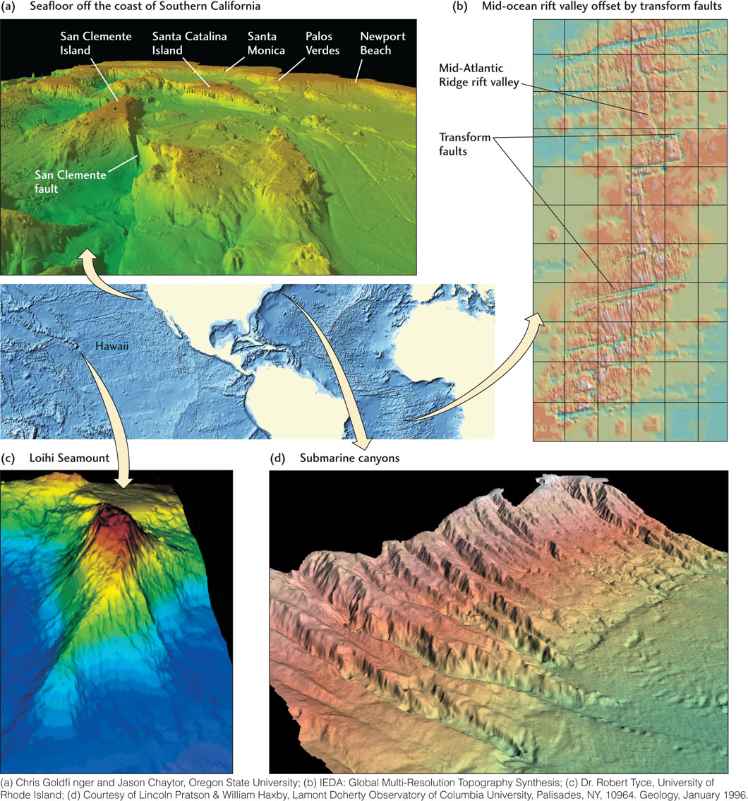
Figure 20.22Four examples of seafloor topography mapped by high-resolution swath-mapping echo sounder arrays on surface ships and rendered by computer processing as three-dimensional images. (a) The seafloor off the coast of Southern California, showing fault-bounded structures of a geologic province known as the California Borderland. (b) The Mid-Atlantic Ridge between 258 and 368 S latitudes, showing the southeast-trending rift valley offset by northeast-trending transform faults. (c) Loihi Seamount, just south and east of the island of Hawaii, the newest in the string of hot-spot volcanoes that form the Hawaiian Islands. (d) The continental shelf (top), slope (central and upper area), and rise (lower left) off the coast of New England. Note the deep submarine canyons that incise this continental margin.