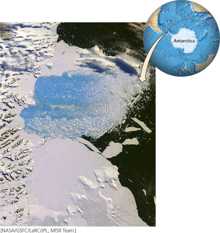
Figure 21.13Collapse of the Larsen Ice Shelf. This satellite image was taken on March 7, 2002, toward the end of a 2-month period during which a huge piece of the ice shelf separated from land and splintered into thousands of icebergs. The darkest colors on the right-hand side of the image represent open seawater. The white parts are icebergs, the remaining parts of the ice shelf, and glaciers on land. The bright blue area is a mixture of seawater and highly fractured ice. The area of the image is about 150 km by 185 km.