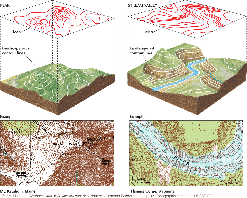
Figure 22.1The topography of a mountain peak (left) and a stream valley (right) can be accurately depicted on a flat topographic map by contours, lines that connect points of equal elevation. The more closely spaced the contours, the steeper the slope.