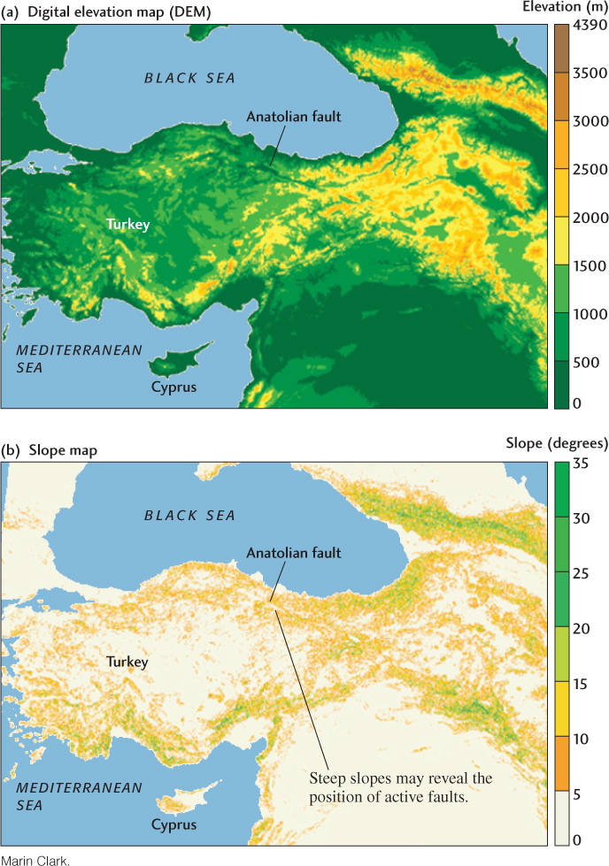
Figure 22.2Topographic maps for Turkey and the adjacent region. (a) A digital elevation model, or DEM. The elevation values are depicted digitally, with each pixel representing one elevation value. (b) To produce this slope map, elevation values from the DEM were used to calculate the slopes between adjacent pixels. The slopes are represented by angles measured in degrees from the horizontal. A slope map is useful for identifying places where changes in topography are particularly abrupt, such as along mountain fronts or active fault scarps.