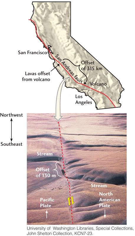
Figure 7.7View of the San Andreas fault, showing the northwestward movement of the Pacific Plate with respect to the North American Plate. The map shows a formation of volcanic rocks 23 million years old that has been displaced by 315 km. The fault runs from top to bottom (dashed line) near the middle of the photograph. Note the offset of the stream (Wallace Creek) by 130 m as it crosses the fault.