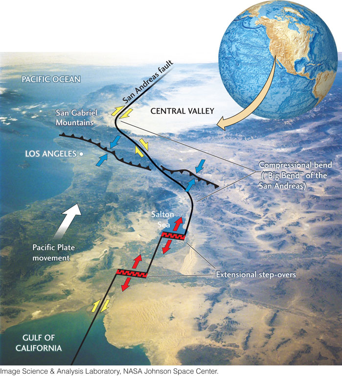
Figure 7.22Space Shuttle photograph showing an oblique view of the San Andreas fault system. The annotations illustrate how the deviations of a transform fault’s strike from the direction of plate motion can cause local extension and compression. Between the Gulf of California and the Salton Sea (near bottom of figure), the fault system jogs to the right in two major steps; the right-lateral fault segments (black lines), which are parallel to the Pacific-North America plate motion, are separated by rift valleys (in red) that are volcanically active, subsiding, and filling with sediments. As we look northward, the fault trace first bends to the left, away from the direction of plate motion, and then to the right, realigning with the plate motion in central California (near top of figure). This “Big Bend” in the San Andreas fault causes compression, which is taken up by reverse faulting in the Los Angeles region (middle of figure).